Can you believe it? ArcGIS Field Maps have been publicly available for almost nine months now! During that time, there have been three major releases with lots of brand-new features packed in. This blog aims to showcase the best of those.
If you haven’t already heard about Field Maps or simply haven’t been able to get started, have a look through our previous blogs which introduce the app and guide you through setting up for the first time.
New Smart Form capabilities
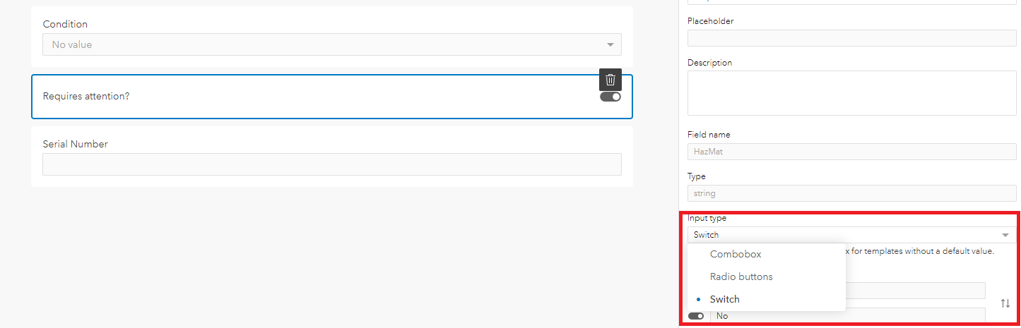
Smart forms are ever-evolving and have gained some great new functions since Field Maps original release. The introduction of new input types; radio buttons, switches and barcode scanner, bring even more customisation potential. The radio buttons are ideal for fields with up to five items so all are visible straight away rather than having to click to open a list, as you would do if you were using the combobox option. If there is a yes/no question, the new switch option may be the best option giving users the option to toggle between two options.

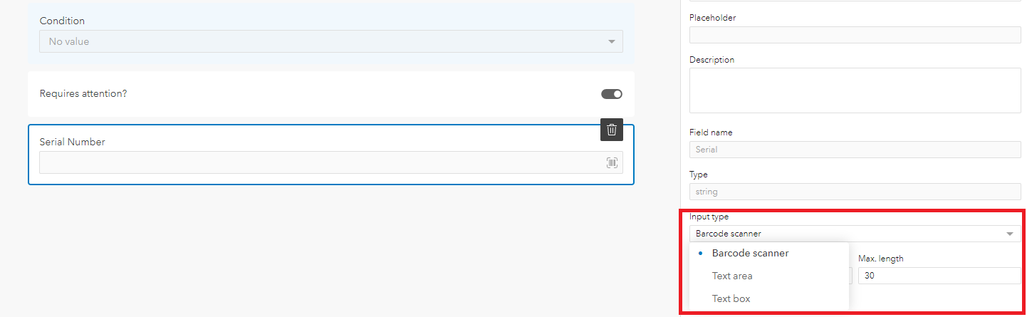
The barcode option allows users to use their mobile device’s camera to scan barcodes or QR codes which can automatically fill in a field. This can be used for reliable collection of longer codes as well as filling out multiple fields by using Arcade to decipher the information stored within the code. Previously, this option was available for all text or numerical fields, but the most recent update allows for the input type to be available for specific fields. More information about barcode scanning in both Field Maps can be found in this article.
One of the most useful features in Smart Forms is Conditional Visibility. The most recent update now allows users to re-use their expressions within the same form so you no longer need to copy the expression if it needs to be applied to multiple fields or groups.
For all fields, a new description option is available. This allows users to have text under the field which can explain how it should be filled out. This is much like the placeholder text available for text and numerical fields but can be used for all fields, which allows for a more unified user experience.
A nice addition to the forms interface is the ability to select multiple fields to be added to your form at once. Seconds shaved off your time building the app.
Tracking improvements
Field Maps can track users’ locations much like the Tracker app. Since launching, it has added more features from the tracker app, as well as some brand-new features. When activating the tracking feature, users can specify the length of time they wish to be tracked, ranging from four hours to ‘until switched off’. Since starting and stopping tracking is solely the responsibility of the mobile worker, the option to automatically end after a specified period of time could be useful for those who could easily forget to switch it off when they’ve finished work.
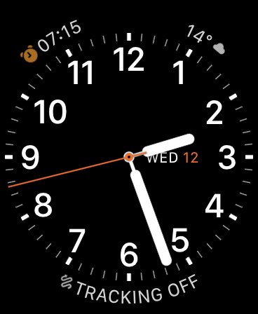 There are also several new ways of quickly starting tracking. Firstly, for those using iOS and have an Apple Watch connected to the device, there is a WatchOS app that allows users to quickly begin or end tracking by clicking a complication on their watch face. Alternatively, you can use Google Assistant to enable tracking by saying something like “Hey Google, start Field Maps and start tracking for 4 hours”.
Tracking is now more accessible than ever with the April update. All users who are assigned a Mobile Worker user type no longer require an ArcGIS Tracker premium add-on license. This means administrators can enable organisation-wide tracking and Mobile Workers can view and share their tracks for no extra cost. To find out more about this change, check out this blog.
If you want your mobile workers to have tracking on when working, there is a new setting that. when enabled, means that users must have tracking enabled to launch the map. The mobile worker will always have full control over whether tracking is enabled but this setting ensures that they won’t forget to enable it when on site.
Web app updates
The web app has a new page for the map settings which was previously on the mobile app. This allows the map author to create the map and control which settings and features they wish the mobile worker to use rather than it being controlled by the mobile device.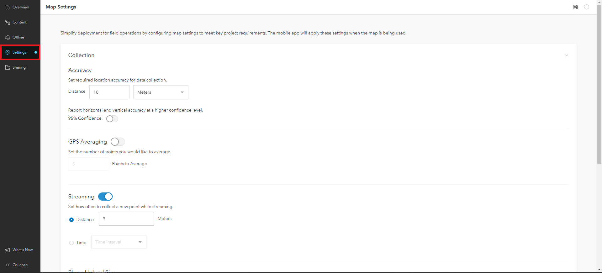
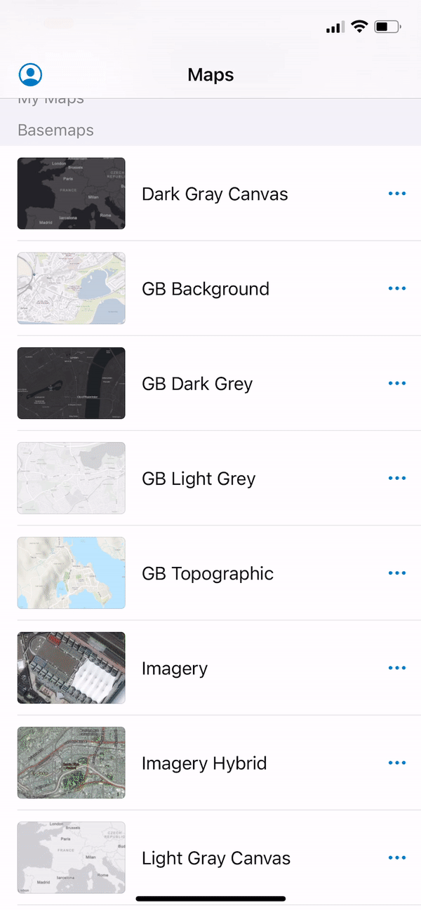
Settings such as photo upload size and show related types are also now found in the web app so that they can be assigned on a map-by-map basis rather than all maps having the same settings within the device. It’s important to note that this feature is not yet supported in ArcGIS Enterprise.
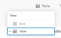 Other new features in the web app include the ability to switch the map page to table view as well as grid view, the ability to add and remove layers from your map and for administrators to be able to view and configure any map within their organisation within the web map.
Mobile app improvements
iOS users now have access to some great new features. Starting off with dark mode support. This automatically reflects your system settings so can be toggled on and off in the control centre. Great for working in low light areas. If you are working with imagery basemaps or those with darker colours, there is an experimental feature that automatically changes the appearance of the interface to match the map. Go to the App Settings > Experimental Features > Adapt Appearance to Map to enable.
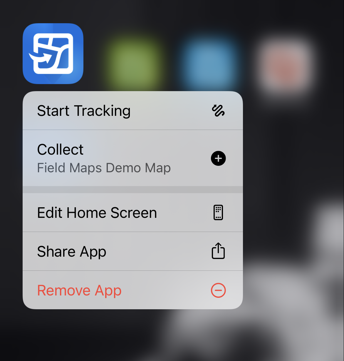
iOS users also have the benefit of Quick Actions by holding in the Field Maps icon on their home screen. This brings up the option to quickly collect data from your most recent map or to begin tracking immediately without having to open any menus.
Screenshots are also improved. Users can Markup the map in whatever way they wish, or not, before taking a screenshot that only shows the map. It’s easy to share, print or save to the device.
That’s the highlights for now, but there is more still to come this year with the roadmap including ArcGIS Workforce integration, the ability to create new maps and content from within the Field Maps web app, and even more smart form capabilities.
For a full list of all the features added and bugs which have been fixed, you can check out the what’s new pages here and here. To learn more about working with Field Maps try this learning plan or, for a deeper and guided dive, have a look at this training course.