 Esri & The Science of Where Podcast
Join us to hear about using maps and ArcGIS to tell a story. Get tips on making the most out of tools like ArcGIS StoryMaps to engage and communicate with your audience.


Have any ideas or feedback? Get in touch.
Related Content
ArcGIS StoryMaps is regularly updated. You can catch up on some of the features added in recent updates in our round up blog post. Look out for links to further resources.
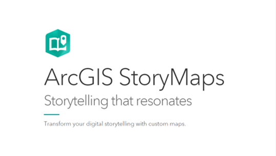
Unleash your creativity and craft stories that connect with your audience. The StoryMaps app gives you free rein to combine maps, text, images, video, and audio to share highly engaging, structured narratives.
One of the best ways to learn what’s possible is to have a look at what others have done. The StoryMaps team maintain a gallery of user stories for us to browse for ideas. Be warned… it can get engrossing.
Telling Your Story
Duration: 0:20:42
START AUDIO
Voiceover: The Spatial Jam, an ESRI UK podcast.
Alasdair: Don’t forget that everything is a story, especially in my world.
Sam: So many different opportunities now to kind of match your brand with the story map.
Beth: Even if you don’t know what your story’s going to be, just start telling it and then you’ll work it out.
Sam: Hi everyone and welcome to the Spatial Jam podcast. Today’s episode is about telling your story with GIS. We’ll be exploring the different story telling techniques within GIS and also discussing the journey of StoryMaps from its inception to present day. So be sure to grab yourself a cup of coffee and settle in for the episode.
Today I’m joined by my two co-hosts and very experienced story tellers Beth and Alasdair. Now Beth, would you even describe yourself as a storyteller?
Beth: Do we get a badge with that on? Because I’d quite like that. I guess thinking about it yes, I do tell stories quite a lot, I use StoryMaps all the time, I think it’s a really good way of taking a technical story and making it more accessible for a wider audience. So yes I’ll take that title.
Alasdair: I’d actually go a step further and say that anybody who works with maps is telling stories. A map always tells a story and part of creating a map is understanding what that story is. One of the things that’s exciting about StoryMaps is that you can share so much more of the story that you can fit into a map or even a series of maps.
Sam: Yes, I think that’s when I’ve seen StoryMaps become the most powerful is when you’ve got a series of different maps that reveal different parts of the story and take you on a bit of a journey. That for me is when a story map is at its best.
Nice to have two good story tellers on the podcast. It would be interesting to touch on the background of StoryMaps first, because I know it’s kind of been on a bit of a journey since, I think its release in 2012 was it? So it’s kind of had almost a 10 year life cycle. Is it 2012?
Alasdair: That sounds about right, certainly they’ve been around quite a long time so I’m sure lots of people have already had a go with them. They’ve changed quite a bit recently which is some of what we’re here to talk about today isn’t it?
Sam: Yes definitely, I think when they first came out, for me anyway, it was one of the first parts of the ArcGIS system that I found so impressive because I’d seen a map using ArcMap and using it at university. StoryMaps was a completely new area of the Platform that I just didn’t even know existed. I think when I first started to choose some of the new templates and kind of play around with Cascade and all of that, that for me was so exciting and the possibilities of telling your story in a completely new way was a massive part of what the ESRI platform had to offer.
It’s also amazing to see how far they’ve come from that first time I used Cascade to where they are now, which is hopefully what we’re going to uncover today on the podcast. I guess the first question I want to pose to you both is what has that journey looked like for StoryMaps and what has your experience been of it interacting with it through the years?
Alasdair: I think when they first came out, it’s interesting that you picked up on Cascade and I’ll come back to that in a minute, the original story map templates were much more map-centric and I guess almost more like a web application with a lot of text. So you could add text, you could add images, you could do all those things that help you to wrap your maps with that wider story and create something that’s more informative and also potentially more report like.
For me, as with all of our technology, I like using it and I get excited about what I can do with it, but it’s also great to see what all our customers do with it. Quite quickly customers were picking up on StoryMaps and using them as a new way to create more dynamic reports and more immersive map experiences where they can link a series of maps and provide that wider context. So that’s been exciting to see.
Sam: I even saw it used a presentation at one of our conferences actually which I thought was a really unique way of using StoryMaps, just to deliver something that wasn’t just a PowerPoint presentation. I thought that was really good.
Alasdair: Yes and I think they’ve even- they’ve recognised that as a useful tool for StoryMaps as well and built some capabilities into that.
Just again quickly, you kind of picked up on Cascade, Cascade for me felt like a shift in terms of the way in which StoryMaps were being created. It was a move from something that was more like a web application to something more immersive and almost more web page style, you got that journey downwards. It felt kind of strange to start with, but then you started to really kind of pick up on how much more engaging that was.
One of the examples I remember from then was an RSPB one with puffins and there were these amazing photos of puffins and the landscapes that they live in. Then being able to move between that and the map side of things so you could create some really exciting content.
Beth: I really love that puffin one.
Alasdair: It was a bit of a hit that wasn’t it.
Sam: I was going to say, I must have demoed that puffin story map about 10 times, it was great. Beth for you, what has your experience of using StoryMaps through the years been?
Beth: I think I probably came into it kind of halfway through its lifecycle so far. I didn’t use it in the early days, I think probably Cascade had come in by the time I started using it. I think for me it was just this way of creating a story, it’s in the name, but being able to create something that looked really good but without very much effort.
For me, I can’t build a website, I don’t have the technical knowledge to do things like that, but you can just add different elements in and create this story that looks professional by the end of it and with minimal effort. I think that’s, for me personally doing my job, is really great.
I could see how that would really benefit customers as well, and you do see it, the puffin story map, we’ve seen loads of StoryMaps coming out from customers.
I think the most important part is that it’s spreading GIS and people don’t really realise, you can send a story map out within your organisation and people don’t think they’re seeing GIS, they don’t even necessarily know what it is, but you’re sharing those maps, you’re sharing that story and really infiltrating those non-GIS users. It’s not even just within your organisation, it’s also outside of that as well, telling that story without people really realising what you’re doing. So GIS by infiltration.
Alasdair: In terms of ease of use, we had a great example shared at our Scottish conference a few years ago. It was one of the councils up here, they’d embraced StoryMaps, they’d used it for- one of the things they used it for was their local plan. So that’s quite a static document, a PDF, a little bit, I suppose quite a meaty document to try and get to grips with. They’d actually created a story map version so it was a lot easier to follow, more immersive, you could zoom the maps in, there were dynamics, you could home in on your town or village and focus maps around that.
But they were also talking about how StoryMaps had taken off within their organisation and one of the examples was, I think it was their apprentices had to create reports and they ended up creating a bunch of StoryMaps. They had no maps in them, they were just using it as a web page tool and creating a sort of presentation that was just because they found it such an easy tool to use.
Sam: That’s really interesting and that kind of brings us quite nicely into the new era of StoryMaps. Because I think traditionally to create a story map you needed a map at the focus of it whereas now you can actually build StoryMaps and you don’t even need to include a map when you create it. I’m interested to know, we’ve evolved into this new generation of StoryMaps, but what is the key difference between where we are now and where we were two years ago?
Alasdair: We talked a little bit about the need to choose what style of story map you were creating before, so the templates were good but there was a kind of, I suppose a rigidity to them, so you were making that choice early on. Cascade gave you some different options, but again with Cascade you basically chose a more immersive experience and that was then the path you were on.
For me the big difference with the new StoryMaps is that although those templates are still there as a quick way to get started, if you know which direction you’re going in you can kind of choose from the beginning. You also have the option just to start from scratch and to start creating something that includes those different combinations. So you can create something that’s, I suppose, Cascade like in part but then have these elements in them that are more like the style of storymap that we had in the other.
Sam: It really demonstrates the kind of direction that StoryMaps is moving in with a massive focus on telling the story rather than designing the map and making sure the map is front and centre. It really allows the user to just completely customise what is the audience going to look at, is it a picture, is it a video, is it a map? I think not having a compulsory map on every single aspect of the story map makes it so much more powerful.
I think that for me, with the new generation of story map as well I think they’ve added in a lot more customisation with them and you can do a lot more with editing the fonts, choosing colours and stuff, which we’ll touch on in a second.
I was going to talk quickly on the JavaScript element of StoryMaps, because I know one of the reasons they’re so powerful, obviously you’ve got the customisation of it, but actually they’re built using the new JavaScript 4. Alasdair I don’t know if you could touch a little bit on that.
Alasdair: Yes, so across ArcGIS there’s a move to kind of start to be able to capitalise on the Arc GIS API for JavaScript 4. That’s showing up with the new map viewer which is now launched in ArcGIS online. So there are new capabilities that come with that in terms of some of the new mapping options and things. Again with StoryMaps the new StoryMaps is built on that platform so it will be able to make use of those new elements, so it will be compatible with the maps that are coming through from the new map viewer. So if you’re working with those new options they should then carry through into your story map.
So that’s kind of where that underlying technology splits.
Sam: My mind jumps straight to making the dot density and pulling that into a storymap which is one of the nice new features of the map viewer.
I know Beth we’ve had a couple of conversations in the past where we get quite excited about very small updates to StoryMaps. You can change the theme colour, you can- basically anything visual that you can change we get quite excited about. I didn’t know if you could just touch on some of the themes in the new storymap and how exciting they actually are?
Beth: Sure, I don’t think we can even explain how excited we were when you could start to pick your own colours. The new storymap styles, it came with default themes which were really nice, they had very different styles to them so there was something that you could use for everything. We all got quite bored of them quite quickly because we wanted to play around with it. So now you can choose your own colours for all of the different elements of it, so you can have different accent colours, different colours for your titles and things like that. So much flexibility and I think tying back to what Alasdair said, it’s all about flexibility now with your storytelling.
There is I guess a negative side to that in that it can become a little bit overwhelming especially if you’ve got a lot of people in your organisation making different StoryMaps and you can end up with a lot of different styles going on that can be a bit disjointed. So one of the really great things that they’ve brought in recently is being able to create and share themes. So you can have for example like an organisation theme, so if you have your corporate logo and you want to match the colours to that, you can have your logo, you can have your different colours. People can then use that template over and over again to make sure that they’re really following what it should look like, especially if you’re going to be publishing those out to the public.
Sam: You dont realise how important matching the brand guidelines is by just choosing a simple colour, and as you say identifying that hex code is so important. I know I had an experience on a project where I was building a storymap, I spent quite a few days building the storymap, it looked great and it was using the Cascade template a couple of years ago. All the content was there and it was really informative, it was really helpful and the ultimate aim for this storymap was to be embedded on the user’s website.
Because we couldn’t fully customise the text colour and the text font when you did embed it on the web page it looked like an Esri story map embedded on a customer’s web page and that whilst it still is informative it doesn’t quite match the brand guidelines and in this day and age I think that’s such an important aspect for people and our users. So we actually ended up not using the storymap which is such a shame, reverting to PDF documents and links out which is- again you get the information but it’s just not got the narrative wrapped around it.
I think one of the things that I’m seeing now, one of the latest updates in the new StoryMaps is you can now link out to Google fonts. So typically in StoryMaps you can chose between, I don’t know, 5 to 10 different fonts, but now because you can access Google fonts you can basically have a library of a thousand plus fonts to choose from. Which is crazy and so many different opportunities now to match your brand with the storymap essentially make it look like a non Esri product, which is the ultimate aim for a lot of our users.
So I think the themes and the customisation of the StoryMaps is the number one priority for me, it is really very useful.
Alasdair: I think that’s part of a wider trend, our technology is there to allow organisations to manage and communicate GIS data and maps, but it should be in their way, in a way that’s right for them. It’s not about doing it, I suppose, the Esri way it’s about giving them the flexibility and the tools that they can make use of and share and communicate their GIS content in the way that’s right for them.
Sam: Yes.
Alasdair: Branding is a part of that. So, yeah, it’s cool.
Beth: One other thing that I really love about StoryMaps is collections. Because if you have a set of StoryMaps that have slightly different ideas within them but they’re within the same general theme you can put them together and then have them in an order that you want people to read them in. So for example we’ve got some training documents that we share internally for people to learn about different elements of the system and it’s a step by step guide through. So they read the first storymap and then they can come back and read the second one, the third one and so on.
You don’t just have to put storymaps in there as well, you can put media in so there might be a story map to start with, then there might be a video or a picture or something and it just goes through the set of items so that people can see them all together. I know our education team use them quite a lot as well to set up learning programmes there, it’s not all just about learning though you can have sets of projects, storymaps together and different things like that. I really recommend using them.
Alasdair: One of the things that I noticed that was in the latest update is that you can now customise, you can now set a theme for your collection. So we’ve got themes in StoryMaps but we’ve now also got themes in StoryMap collections as well.
Beth: Something new for me to try out later on, we’re learning all the time.
Alasdair: Every day’s a school day in our world.
Sam: I guess one of the other nice new features with the new StoryMaps is the ExpressMap as an extension of the customisation option. Typically when you want a map in your storymap you have to go and create it in a separate place, not just online. Whereas the introduction of these Express Maps are a way that you can design and create a map within your storymap. I don’t know if either of you have used Express Maps much and what’s your experience of them been like? Are they express, are they easy?
Beth: To be honest I’ve not used it that much but the few times that I have it is really simple and it is really easy and quick, so I’d say Express Map is probably a good name. I think probably one of the important parts is that you don’t have to have a licence for any other part of the ArcGIS system now to be able to use StoryMaps, so being able to create those Express Maps is really a key part of that as well.
Sam: Because you can add in arrows and really high level annotations to the map can’t you?
Alasdair: Yes, I think I used a label symbol, an arrow, and some text as well.
Beth: I think we sometimes forget how powerful really simple things can be. Just having some points on a map and some arrows and some sketches, it might seem to a really in depth GIS user that’s really basic, but sometimes it’s all you need and so it really can help bring that story to life. We need to not forget how powerful it can be.
Sam: Sometimes you just want to change the colour of your font and that gets people excited.
Beth: That gets you excited Sam.
Sam: It gets me excited yes. I guess we’ve touched on a lot of the benefits of StoryMaps and uncovered the way you can tell your story through that. I’m interested to talk about other parts of the ArcGIS system and ArcGIS online and how you can tell your story in different ways. Because I know there are other opportunities within ArcGIS online, different apps that you can use.
Have either of you had experience of telling a story through a different way and not using a story map?
Alasdair: I have actually Sam, I’ve kind of used a range of the different options. I think, going back to what I said at the beginning, even if you’re just creating a simple web application that’s just showing a map you’re telling a story, so don’t forget that everything is a story, especially in my world. But I think one of the other things that- StoryMaps give you so many different options, they are a great way of adding that wider context to a map.
The web application builders also give you a degree of that, so it depends how far you want to go and what you want the focus to be I think. Or with Experience Builder you can actually start to create something that’s almost a hybrid between StoryMaps and a more traditional web application.
Beth: Hub is actually a really good tool, I’ve used it a couple of times, we’ve got a few different sites that use it and it is a more in depth way of telling a story. I guess it goes a little bit beyond telling a story, sometimes you can have data sets up there, you can have people interacting with things, they can send you messages, they can fill in surveys and different things like that, which obviously you can link to from StoryMaps. But it’s a bigger thing, it’s a hub for all of those different things that you want them to interact with or view.
A really good example of it is Esri Inc’s racial equity hub, they’ve got stories, information, data sets, all different things on there. It’s a nice way of bringing together a lot of different elements and also you retain control over it. You can go in there, you can customise just in the same way that we’ve been talking about with StoryMaps, changing the font, the colours, everything like that, putting different elements in where you want them to be.
So again we’re keeping that customisation that flexibility, but it just goes a few steps beyond what you can do with a story map.
Alasdair: I guess the other thing just finally from me would be don’t forget to keep an eye on what changes. I went back in to check the name of the map tour and discovered there’s a whole extra side to map tours that I hadn’t spotted. They’re updating it really quite regularly and it’s just going to get better.
Sam: Thanks so much for listening to today’s story telling episode, hopefully you picked up a couple of pointers to try out the next time you’re telling your story through GIS.
As always, thanks to both Alasdair and Beth for their wisdom and storytelling insight. If you do have any thoughts or feedback on the podcast please do drop us an email, we’d love to hear from you at podcast@esriuk.com, otherwise be sure to subscribe and favourite on your chosen podcast channel because it really does make a difference.
Thanks so much for listening and we’ll see you next time on the Spatial Jam podcast.
Voiceover: The views of the presenters may differ from those of ESRI UK.
Alasdair: Yeah that’s it, got to sit still, everybody comfortable?
END AUDIO