 Esri & The Science of Where Podcast
Join the Spatial Jam regulars for a meeting of the ArcGIS Pro Appreciation Society. On the agenda are favourite features, some hidden gems, and tips for a smoother Pro experience.


Have any ideas or feedback? Get in touch.
Related Content
ArcGIS Pro regularly features on the Esri UK Tech Blog. You can catch up with what’s new in the updates or get tips on workflows. Our map team also post regularly on how they create their cartographic delights.
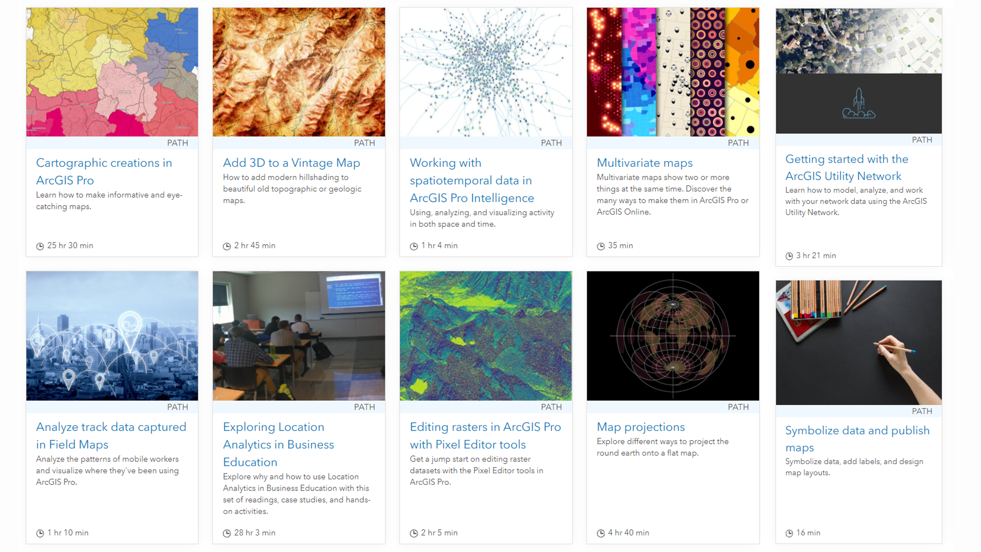
Whether you’re new to ArcGIS Pro or looking to experiment with new tools and capabilities, Learn ArcGIS provides you with lessons dedicated to ArcGIS Pro, free for you to discover.

The Esri Communities are a great place to ask questions and get tips and there’s one dedicated to all things ArcGIS Pro. It’s also home of the ArcGIS Ideas - your chance to influence the development of ArcGIS Pro.
The ArcGIS Pro Appreciation Society
Duration: 0:25:38
START AUDIO
Voiceover: The Spatial Jam, an Esri UK podcast.
Beth: Make your day-to-day job just so much easier.
Alasdair: Chart and Pro are just a, kind of, different level.
Elleni: Many people don’t know it’s there. It’s quite hidden away.
Beth: Hello and welcome back to the Spatial Jam podcast. Today’s episode is all about ArcGIS Pro. We’ll be covering some of our favourite features, hidden gems and also some tips, just in case it’s not going quite to plan. I’m Beth, and today I’m joined by Elleni and Alasdair, avid users of ArcGIS Pro. So, let’s kick things off. Elleni, what’s the best thing about using ArcGIS Pro.
Elleni: Oh, a lot of things at the moment. One of my favourite things about ArcGIS Pro is its wide support for a number of different data formats. It’s not just, you know, the usual shape files, or file databases that Pro supports. It’s a wide variety of data now. So, things like CAD data, LiDAR, a huge amount of data sets that is natively read. So, that has opened up a huge range of opportunity and possibility for users.
Beth: Yes, that’s so true. Alasdair, what’s your favourite thing about using Pro?
Alasdair: As well as the application, you know, some of the features within the application itself. I think, one of the big things is how well it then integrates with the wider ArcGIS system. So, if you’re working with web services, whether you’re preparing and publishing them, or you’re working with a mixture of data coming from a web service, and so, maybe, some local stuff that’s on a file geodatabase, or a direct database connection.
Within that desktop environment, you have the same kind of ease of use of that web content, as you would if you were working in portal. So, that integration with portal and the ability to look at what’s in the portal, find the web service that you want to bring into your map. Or even going out beyond your own content and reaching out and pulling things in from places like Living Atlas, as well as it then being easy to prepare data within Pro, for publishing through into the web as well.
Beth: Yes. For me, I think that usability aspect is really important. When thinking back, using ArcMap, you normally had to know where you needed to look to find the tool that you wanted to use. With ArcGIS Pro, I find it’s a lot more user friendly, especially for brand new users. The ribbon interface, for me, just makes a lot more sense. I do remember, though, switching from ArcMap over to ArcGIS Pro, and it was all a bit like, “Oh, my God, where has everything gone? It’s all really very different.” I found I quickly got used to it.
So, if we’ve got listeners out there that are worried about making that switch, or you’ve just changed over, I say, it really does get easier as time goes on. You’ll wonder how you ever worked without it, I think. Going back to ArcMap, you’re kind of, “Oh, God, where have all the buttons gone again?”
Alasdair: Yes, I’ve had that same thing, Beth, of making the jump, getting used to where everything is in Pro, finding it a lot more direct, some of the ways that you access information in Pro. You know, it’s fewer clicks to get there. Not so many right clicks. There are a lot of right clicks in ArcMap. If you’re new to either then, people are picking it up quick, I think.
Beth: Yes, definitely.
Elleni: That’s a key, part, I think, of ArcGIS Pro, is that they’ve recognised, with ArcMap, although it was all one workflow, you had to have open, potentially, ArcMap, ArcCatalog and ArcScene, to do a number of different things. Now, with ArcGIS Pro, it’s just all within that one application. So, it just makes it a whole lot easier to work with data.
Alasdair: Yes, and you mentioned 3D there, Elleni. That’s one of those interesting things where, whether or not you have 3D data, and whether or not you think you need 3D, suddenly you have the choice. You know, if all your data is two-dimensional data, you have the option to flip your view, and then you can see your two-dimensional data, within three-dimensional landscape. That can be quite useful, I think, and open things up in a different way as well, without having to go and find an obscure piece of software that you can’t remember the name of.
Elleni: Yes, and Beth, I think you mentioned, as well, about ArcGIS Pro, the ribbons, and how it just makes sense. One of the things that I’ve really enjoyed, myself, working with ArcGIS Pro, is not just the usability factor. Everything is in one place, but it also recognises what data format you’re working with. So, if you’re working with CAD, the ribbon shows you CAD tools to work with that CAD information, so georeferencing tools. It knows what you’re working with.
So, in that sense, it’s also guiding users to perform the right workflows, rather than kind of getting stuck. They bring the data in and it’s like, “Okay, what next?”
Beth: Yes, I’d actually completely forgotten about the contextual menus. Obviously, I use them all the time, but you forget that it’s a feature that we just didn’t have before, and that they are so useful. You just get ingrained in what you’re doing. So, having a think about how you actually use ArcGIS Pro on a day-to-day basis, how do you make your life easier, in terms of setting it up, so that every time you open up a project it’s ready for you to use, and you don’t need to redo all your settings, every time, for example? What are those things that you do to make your life easier?
Alasdair: I suppose, everybody has their own preference about where they position things, and people have their own idea about where, in the screen space they want some of those key tool panes to be. For me, I actually use it with someone either side. I have the - it’s not called the ‘layers pane’ it’s got a different name. Content pane on the left, and then the Symbology pane, I have docked with that.
So, if I’m setting up new data, I can quickly flip between the two, and that’s one of things that I quite like. It is completely customisable; you can mix it around and you can set it up the way that you want.
Elleni: Yes, I would completely agree with you, Alasdair, on those. ArcGIS Pro allows you to be completely flexible in that sense and move panes around. One of the other things that I’ve found really useful, in terms of making it work for me and making it easier to get set up, is setting default geodatabases, and default toolboxes and default saving locations for data. You can do that very easily in the ArcGIS Pro options. It just means that every time you open up a new project, or you start some new work, everything is there ready for you to go.
You can even go as far as setting the coordinate system, what base map you want, and what layers you want as that default template. So, you’re not having to start from scratch every time, which made my life a lot easier.
Alasdair: Yes, and the other nice thing on that, Elleni, is there are some different ways of doing it. You mentioned going into the options and setting the settings in there. One of the ones that I did, fairly early on, was change the default base map. It picks up your connection to a portal, and it defaults to using the default map. That’s a lot of defaulting. The default map for the portal has your default in Pro. Actually, I didn’t want it to be that; I wanted it to use a different one.
With things like folder connections, you can favourite them, in the same way that I’ve done previously, with things like projections. I’ve got favourite projections. I have two BNG and Web Mercator, but you can favourite folder connections. The other thing you can do is, with Pro you have a project. So, every time you start a new piece of work, you’re creating a project. You can actually set up a project template.
So, you can have a project template that includes database connections; it includes folder connections to key folders. You can include styles into it. You can include layouts as well, which is quite a key thing. Every time you create a project, all of those things arrive already there. You can even have a map. If there’s a standard starting place for all of your mapping, then you can have that as part of your project.
Beth: I think a really nice part of that, as well, is that you could package it up and share it with your team, or others within your organisation. So, if you want everyone to be starting from that same point, you can share that with them, to make sure you are all using the same base map to start off with, that it’s in the right projection, you’ve got the right folder connections and things like that. So, that’s really useful.
Alasdair: In terms of things that I didn’t spot, straightaway, with Pro, there is a quick launch bar at the top that has a few commands in it. You can put things up there as well, so I ended up adding the geoprocessing tools, because it always took me a couple of minutes to remember which of the ribbons I needed to go to, and find where to open the Geoprocessing pane. I’ve added that as one of my quick launches.
Elleni: That’s such a good idea, Alasdair. I think I’ll be doing that as well, and actually really customising that ribbon. There are so many tools in ArcGIS Pro, that I will probably never use. Just getting rid of anything that I don’t need for my own workflows, streamlines that a lot more. I think, one of the other things that I’ve noticed, when you open up ArcGIS Pro, for the first time, right on that front page, I think beginning from about 2.7, there is a whole list of helpful documentation links and training links.
So, quite often, users starting with ArcGIS Pro, they are presented with those the first time, and then can get the help that they need.
Alasdair: Talking about documentation, if you’re a fan of using quick keys and have shortcuts for things, there is a document that has all of the shortcuts. If somebody is good at remembering them, then I think that can speed up your workflow quite a bit, I’m just not one of those people. I can’t even remember my telephone number.
Beth: I’d completely forgotten about quick keys. With any piece of software, we’ve all experienced it, where something, maybe, isn’t running as smoothly as when you first installed it. Have you got any tips on how to keep Arc Pro running that little bit more smoothly?
Elleni: I would say definitely check out the core options on the options pane of ArcGIS Pro, that’s on the settings options. One of the things that I’ve found really, really useful, is here you can, actually, set different display performance settings. Now, as default, ArcGIS Pro will try and sell itself to the highest performance setting. What I found is, sometimes that’s not needed, and sometimes I actually want a lower setting. It means that my data loads quicker. That’s just the case of the machine that I’m using.
Alasdair: Mentioning some of those settings, Elleni, you mentioned 3D. I think, if you do find that you’re starting to work with 3D data, then there are definitely some other things to watch for. The quality setting is one of them. So, you can choose, basically, do you want things to draw fast but not look as good, or do you want things to be rendered really well, but that’s going to take a bit of time. There are also some other things that you can do. We’re all used to using scale threshold in a two-dimensional map to manage complexity, and to manage draw times.
Within 3D you have a similar mechanism, but it works slightly differently, and it becomes about distance. It’s distance from the viewer position to control that. It might be that you don’t need all of the buildings or pylons, or whatever they are being rendered in glorious detail in the background, because you can’t really see them anyway.
Again, I’ve found some of my projects were getting quite slow to open. I realised that’s because I had three or four maps open. It’s then trying to load those maps as you open the project. Closing some of your maps down before you- Or maps and scenes in particular, actually, 3D scenes, in particular. Close them down before you exit the project and save, because next time you’re not waiting for things to load that you’re not going to use.
Beth: On that point, Alasdair, what I think is also really useful, if you’re going to keep a map open, once you close a project, if you’ve got large data sets in there that are currently turned on, just turn them off, so that once you’re first loading up that project and that map comes on, you’re not loading all of the address points in Great Britain, for example, and you’re having to sit there waiting for it, or pausing it.
Similarly, to that, there are settings so that when you bring in a new layer, or a dataset, it can either draw automatically, as soon as you bring it in. Or it can be defaulted to be off, and it won’t, automatically, draw. If you’re bringing in a national dataset, if it’s the first dataset you’re bringing in, it will zoom to the full extent of the dataset and start drawing it, which can just slow everything down. So, definitely recommend having that turned off as a default.
Elleni: That’s a really good point as well, Beth. I think, when you’re adding a new dataset to a new map, for the first time, the coordinate system that that dataset is in, will mean that your map automatically changes to that as well, which means sometimes, if your base map is in a different projection, then it does take a little bit longer to load. So, if you’re used to work in something like, BNG, make sure that you’ve got default templates set up with BNG, or vice versa if you’re working with more Web Mercator datasets, more world datasets, then make sure that the base maps you’re using are the right coordinate system of the data that you’re working with.
Beth: I think we’ve worked out some of that housekeeping that we need to do, to make sure everything is running smoothly. Let’s move onto the more exciting things. What are our absolute favourite things about ArcGIS Pro? So, Elleni, what are some of your favourites?
Elleni: I’m actually going to jump straight in to one of my favourite toolboxes that was released with, I believe it was 2.7 of ArcGIS Pro.
Alasdair: That’s pretty niche, Elleni, going straight for a toolbox.
Elleni: Straight for a toolbox, not even a small tool or widget in ArcGIS Pro, straight for the toolbox. The toolbox in question is the GeoAnalytics toolbox. And the reason being, is this toolbox enables you to run a lot of the spatial tools that you’re used to working with - so, things like joins, finding hotspots, aggregating information - but it does it in a way where it distributes the load of that task across parallel tasks on your computer. So, it means that it’s working and analysing that data a lot more quickly. You get a result a lot more quickly.
I think, the reason why this is one of my favourite toolboxes to come out, is simply because, I think, we’re all aware of the industry trend at the moment. It’s all about big data. Having a toolbox that is, specifically, designed to do that and to do it efficiently, has just changed the game for me. It’s really cool. You can tell instantly, in ArcGIS Pro, if it is one of those tools that uses parallel tasks, it usually has a little symbol by it, or it has the Apache Spark symbol.
They are actually available in the advanced licence of ArcGIS Pro. So, if you’ve got the advanced licence, they are there ready for you to make use of. So, definitely check them out.
Beth: Alasdair, how about you?
Alasdair: It’s a tricky one. Am I allowed two?
Beth: You can have more than one, yes.
Elleni: I definitely have more than one.
Alasdair: That’s good. We could be here for a while then. The geoprocessing history, I think, is a really nice feature that, because Pro uses a project concept, your geoprocessing history now becomes saved as part of the project. So, when you’ve worked on something for a while, and then you step away from it and you come back, you can go in and you can look at the geoprocessing history. You can see what you did to derive the layers that you’re looking at.
I think that’s a really nice encapsulation. You can even use that geoprocessing history to then, if you want to go on and create a model to automate something, you can actually add things from the history to the model. Not only does it add the tool, it carries over the same parameters. You don’t have to go back and recopy your parameters and set those as well.
Then, the other one that I was going to mention, which came in, I think, in the most recent version, so in 2.8. They’ve added a quick search function at the top right corner. So, not only does this mean that you can search for geoprocessing tools, and that’s built into the toolbox and the way the toolbox works, it will also search commands. If there is a command that you haven’t used for a while, you can’t quite remember which bit of the ribbon it’s on, you can just pop the text into the search window at the top and it will show you anything that matches that text. So, it will pull up commands and tools as well.
So, even as a regular user of ArcGIS Pro, there are bits that you forget where they live. So, it’s a quick way of finding those. But as a new user, that would be just such a handy thing to have.
Elleni: Am I allowed to add one more? I really want to.
Beth: Definitely. Go for it, Elleni.
Elleni: A really, really nice addition to ArcGIS Pro is the integration of Jupiter notebooks, which, I think, for many users who are used to, maybe, working with Python and Python Libraries, to be able to do spatial analysis or data engineering, being able to have that notebook integration with ArcGIS Pro, just makes things a lot more streamlined.
I think, just to add another one onto that as well, separately, Alasdair, you mentioned this the other day. I know you work with 3D data quite a lot. The ability to have those linked views. So, you can actually dock, perhaps, a 2D map and then the 3D view of that same data side-by-side. Then, if you’re moving or changing scales on either side, then it will actually try and shift. It will keep those views linked. I think that’s really important if you’re working with quite complex data, or maybe you want to overlay different information in the same area. Being able to see those side-by-side, really quickly, is just a really nice functionality that I’ve enjoyed using in ArcGIS Pro. I think, many people don’t know it’s there. It’s quite hidden away. So, yes, make use of it.
Alasdair: You mentioned using 2D and 3D and having a linked view so you’re navigating the two together. You could even do it with 2D maps as well. You could have two 2D maps that are showing quite different datasets, or whatever it might be. Rather than having to keep turning layers on and off to flip between views, or using a swipe, or whatever, you could actually just have two maps that have those two different sets of information, and use the synchronised view. It becomes, almost, a dashboard-like experience, in terms of navigating the maps and interacting with them.
Again, on that whole thing with multiple maps, if you’re creating maps, if you want to add a layer from one map to another, you just copy, paste. It’s that simple now. I really like that. You don’t have to export the symbology or create a layer file.
Beth: Glad you’re so excited about copy and paste. Who knew that would be one of your favourite features?
Alasdair: It’s the small things that keep me happy. I haven’t even gone to the colour picker in the symbology tool yet. You can just pick a colour off your map that already exists. And you can copy colour codes. You can save colour codes if you’ve created a custom colour. You can save that to your style library.
Beth: That’s normally the kind of thing Sam would be popping up with.
What I found here with everything that we’ve said so far, is that a lot of these things are really small, little functionality. It’s the things that make your life easier that, you don’t really notice them, until you start thinking about it. You’d obviously notice it so much more if it was really annoying to use. So, it’s just making that as easy and as straightforward as possible to make your day-to-day job so much easier.
Alasdair: You’re right Beth. We’ve talked about some of those small things. They are what make life easy for us. We haven’t talked about the layout. So, with Pro, one of the big changes is that you can have multiple layouts within a project. So, you can have multiple maps, but you can also have multiple layouts. Within the layouts as well, I’ve used them a bit more recently, and I’ve found them a lot more flexible to work with. So, being able to do things like add different elements into your layout, it’s really easy to control the order in which they’re drawing.
You can rename the individual object, so it becomes obvious which one is which. Nice features like that in the way that layouts, themselves, work, as well as that ability to have multiple layouts so that the map- You know, you’re choosing a layout and a map, and then you do your export. Then you can export another map using that layout. To support those, the other thing, and I know I’m supposed to stop and not go on forever, but charts.
Charts in Pro are just on a different level. They are something that, with each release we’re seeing more and more come into that charting capability. So, not only can you create some really nice clear, clean looking charts within Pro that you can include into your layouts, but those charts, they’re starting to become interactive. So, you can use them as a data exploration tool. You can have a chart on a map, and where you’re selecting things on the chart, it’s changing the selection on the map and vice-versa.
Beth: There is so much functionality we all need to go and try out. I think we’ll be spending our afternoon doing that today. We’ve gone through a lot of different tips and tricks today, but Elleni, where can people go if they want to find out a little bit more about the things that they can do to help with their ArcGIS Pro world?
Elleni: Beth, earlier you were mentioning all these small things that help us to work with geospatial data more easily and ArcGIS Pro and help make our lives easier. I think, one of the things that helped me get to that stage where I could find out all those nice little tools, with nice little workarounds to make my life easier, was doing the learning paths, doing the Esri training online. It might not be relevant in terms of the use case that they’re using in the learning path. It might be something completely outside your domain.
If you follow those paths, what you will pick up on are all those little tips and tricks. So, using linked views, being able to use the quick search bar, it will just get you used to working in that way. Which means that, when you next open up a project to do your work, you’re like, “Oh, yes, I remember in that little learning path they told us to do this. I’m going to try that out.” Then, suddenly, you’re working a lot more quickly with your data, and you are able to produce results quicker. So, definitely check out the learning paths of ArcGIS Pro online, and the Esri training learning paths for ArcGIS Pro.
Alasdair: The other thing with those learning paths, Elleni, is that they are a great way to get started with some of the simple things, but they are also excellent for some of the advanced things. Not only do they show you have to use them, but they also provide you with the data that you need to try it. As an example, so, something like machine learning, if you’ve never worked with a machine learning model, it will take you through what you need to do, but it will also provide you with some example data that you can try out with, which you might not have. Not everybody has high resolution imagery lying around in their desk drawer.
Beth: Speak for yourself. (Laughter)
Alasdair: The other place that I think is really important to remember, is the Esri community site. I actually did a quick look for top tips before coming on this, and somebody has created a section on the Esri community site that, I can’t remember what they call it, but basically ArcGIS Pro top tips. There are some really nice ones in there and some really good ones. That’s where I found out that I can save custom covers. I’m a happy man.
Beth: So, the great thing about the learning paths and the community, and things like that, is that you can dip in and out of them really easily. Some things are a quick search or a 15-minute video, something like that. If you’re the kind of person that needs to have the time and the space dedicated to learning something, then obviously we also have training courses as well, which are really great for just taking that time out to really learn what you need to do.
So, have a look at the learning services that we do offer, as well, if you do think you need that extra help and support to get yourself started, or to even just take yourself further than where you currently are.
So, that’s everything for today. Thanks for listening. We’d love to hear what you think, so please do get in touch at podcast@esriuk.com and don’t forget to subscribe and rate us on your chosen podcast channel. It really does make a difference. We hope you’ll join us again.
Voiceover: The views of the presenters may differ from those of Esri UK.
Beth: Okay, bye. Can I just do that? (Laughter)
END AUDIO