ArcGIS Online is a web mapping solution, hosted entirely in the cloud and delivered as Software-as-a-Service. Access to ArcGIS Online is included with our ArcGIS Desktop product licences, or you might have a licence as part of a collaboration project. If this applies to you, or if you are considering purchasing a licence, you may be interested to learn more about maximising the value that you get from that licence. In this post I outline how ArcGIS Online can be put to use, even with just one named user licence.
ArcGIS Online provides templates and builders to enable the production of interactive mapping applications, without the need for web development skills. The technology is scalable, which allows you to share public-facing web maps widely, without concern that your servers cannot support high usage. The product also supports secured sharing of data and maps between users.
Collaboration
Because the product enables secured sharing of data and maps, all within a web browser, it is increasingly being used for collaboration projects between organisations. For instance, in Local Government, councils use ArcGIS Online to collaborate with their neighbouring councils and 3rd party organisations, such as contractors. Collaboration use cases include public health emergencies, or sharing planning datasets.
Citizen Engagement Apps
Because ArcGIS Online can scale to meet demand, the product is popular for sharing public-facing mapping applications. Included are application templates that enable ‘find-my-nearest’ functionality, survey functionality with a location capture, and other tools, along with the standard tools that you would expect from a web map including address search, pan and zoom, display pop-up, measure, etc.
These templates are used across local government to offer transparency around projects, deliver online report-it apps (Environment – Graffiti, Fly-tipping; Highways – Potholes, Streetlights; etc) and to enable citizens to locate their nearest services (Recycling Centres, Polling Stations, Libraries, etc).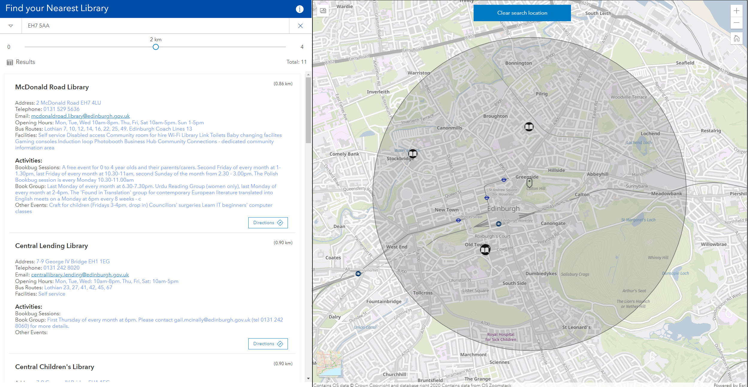
Some of the included templates provide ‘Story Map’ capability, which can be used to combine text, images and videos with interactive maps to tell a story around the data that is presented. A common use case for this is to present a Digital Local Plan.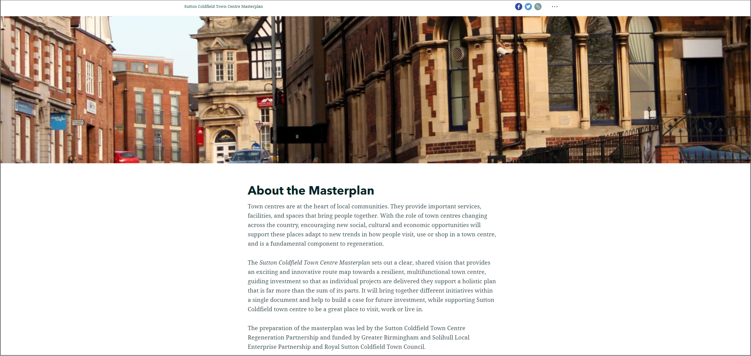
Example applications can be found via our Government Customer Example Gallery (filter using the tags on the left) and our Sunnyshire Example Site.
Access to Datasets
ArcGIS Online includes access to a range of datasets. There are a variety of basemaps/ background maps to add context to your data, aerial imagery, live traffic data, boundary datasets, population data and more. The ArcGIS LivingAtlas can be used to start searching the datasets that are available and adding them to your maps.
In addition to the datasets available through the LivingAtlas, it is also possible to consume 3rd party content served via APIs. This includes data provided by Ordnance Survey and you can learn more in this post.
Open Data
ArcGIS Online includes ArcGIS Hub, which makes it easy to host and share open datasets. The application can be used to serve both geographic and tabular datasets, so can act as your single repository of open data. End users of the application can choose to view a preview of the data (on a map if relevant), download the data or connect to it via an API.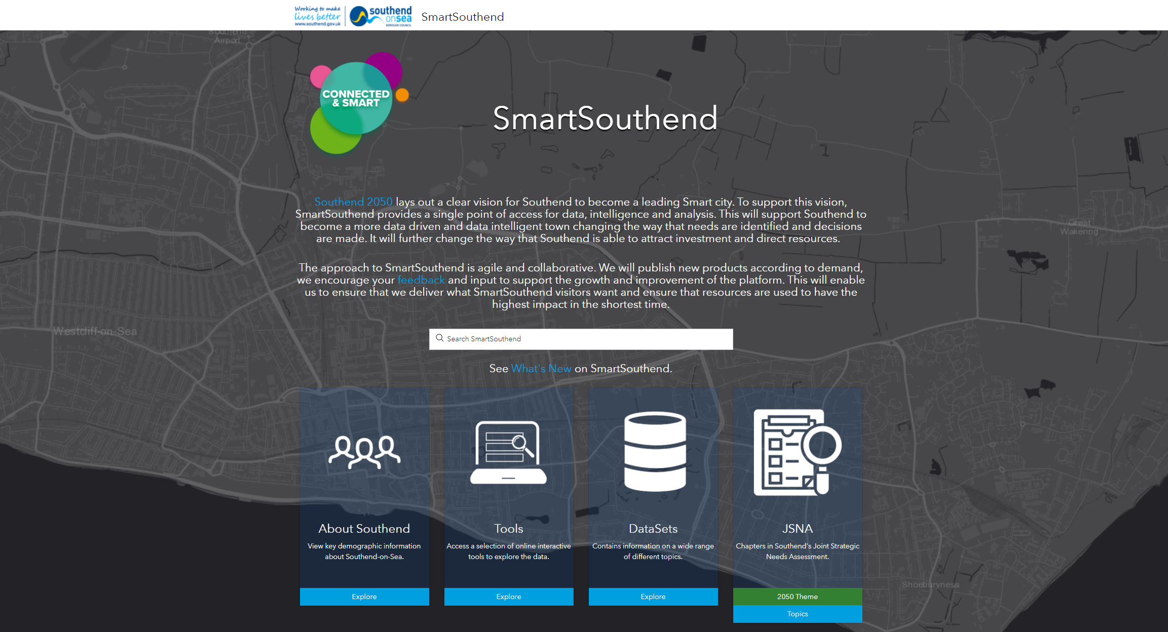
Example Open Data sites can be viewed via the Government Customer Example Gallery by using the Open Data tag filter on the left-hand side of the gallery.
Field Data Collection
Web mapping applications built using ArcGIS Online are mobile-ready and can be accessed by any device with a web browser. In addition to this, your ArcGIS Online licence can unlock access to native mobile applications that are built to work with Android or iOS operating systems. This enables streamlined mobile data collection in the field, allowing for situations in which mobile connectivity is limited or unavailable.
If you’d like to know more, please contact your Customer Success Manager or sales@esriuk.com