What better way to start off the New Year than by catching up with the latest updates in ArcGIS Living Atlas of the World? In the last blog, I shared with you some of the new and noteworthy contributions from the UK alongside some Data Curator resources. Since then, we have welcomed 25 new datasets and 3 new data contributors – including The Scottish Government, NatureScot, Cadw and collaborations with the Met Office!
In this blog, I will share some of the latest updates from Esri UK and highlight some of our newest contributions. We will be looking at the following topics:
-
Environment
-
People
-
Living Atlas updates
-
Learn more about Living Atlas
Environment
Explore the risk of climate hazards with the British Geological Survey
The British Geological Survey contributed another great dataset to Living Atlas – the GeoClimate UKCP18 Open data. This shows the potential change in subsidence in 2030s and 2070s due to changes in climate. The results were developed by combining long-term UK Climate Projection scenarios for rainfall and temperature changes with geotechnical ground properties.
Shrink-swell ground movement (subsidence) is one of the greatest and most damaging geohazards the UK faces today. This dataset can be used to prevent and mitigate the impacts of this on property and infrastructure, especially for those in construction and utility industries.
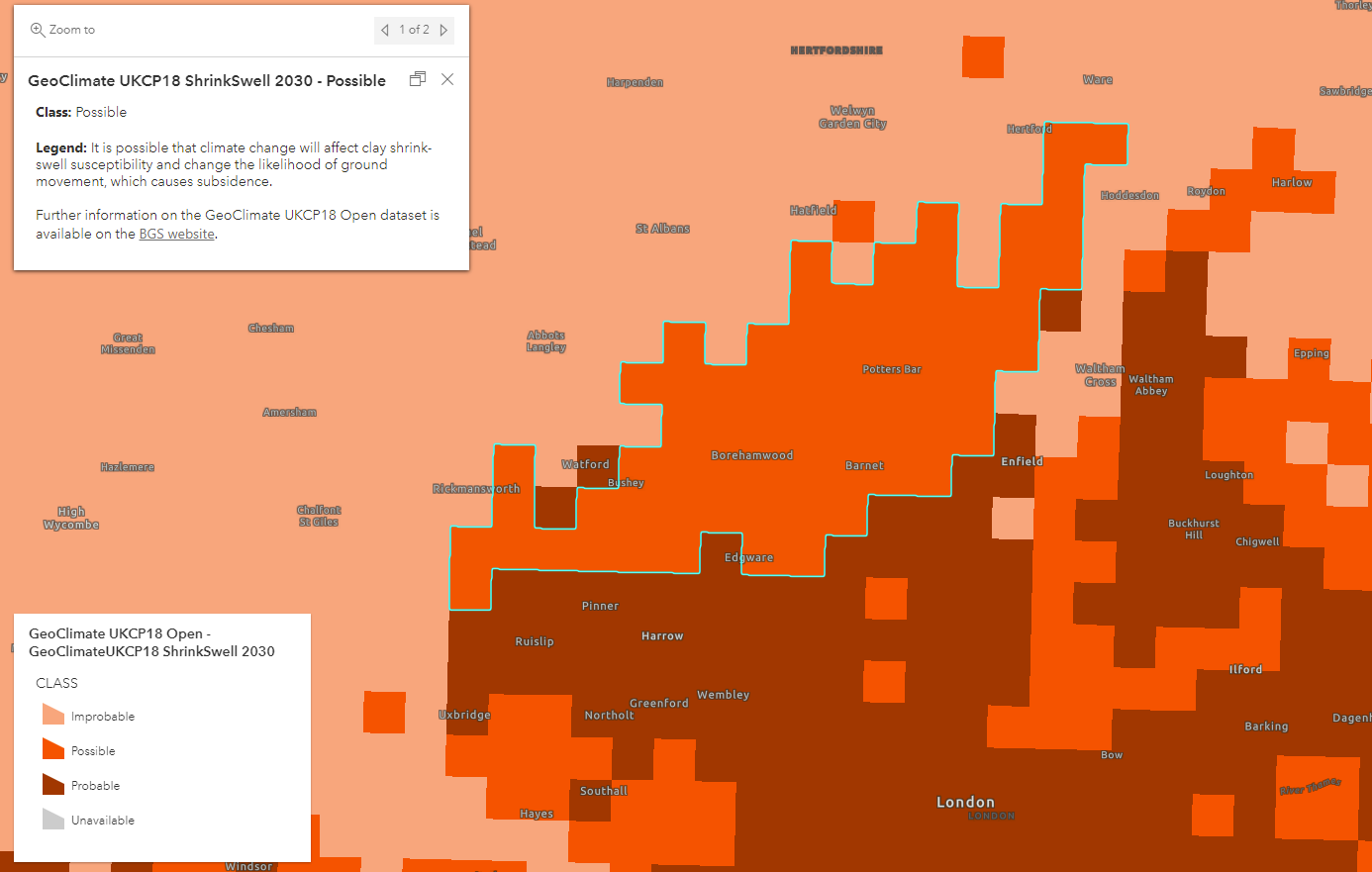
The British Geological Survey’s GeoClimate UKCP18 showing risk of subsidence in an area in North London.
Understand the impacts of climate change with these dashboards from Esri UK and the Met Office
As part of COP26, Esri UK’s Education team created a comprehensive set of climate change resources, designed in collaboration with the Met Office. Currently, they have released 10 dashboards and have shared these to Living Atlas to help users learn about the future impacts of climate change. From health, agriculture, transportation, precipitation to temperature and more – you can explore the impacts on a local and national scale.
Check them out here and find out more on Esri UK’s Teach with GIS website. You can also re-watch the webinar introducing this project by registering here.
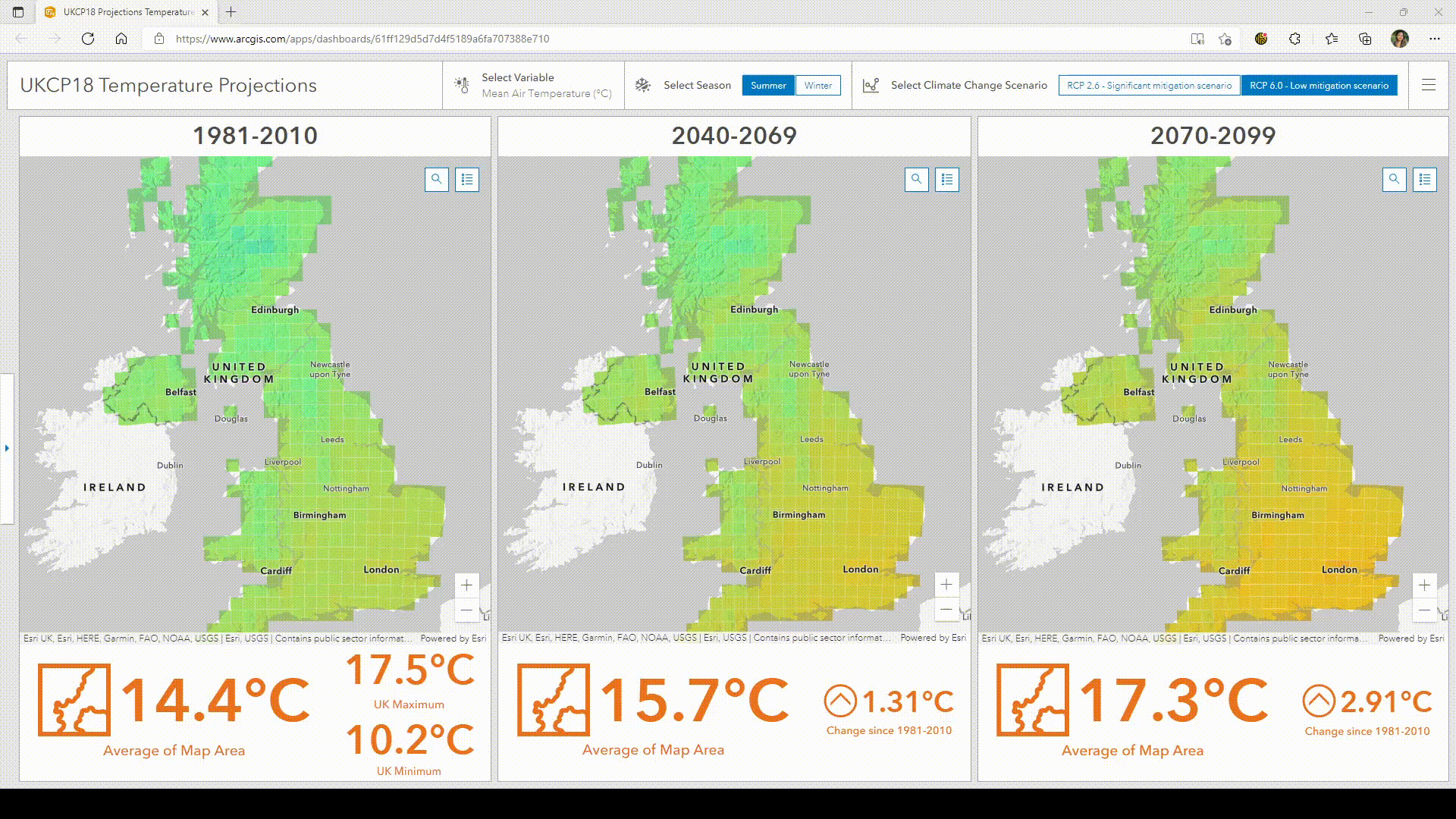
Exploring UKCP18 temperature projections for the UK.
Monitor the changes in the moorlands with Natural England’s maps
Natural England have contributed two new additions to Living Atlas – Moorland Change Maps (2018-2019 and 2019-2020).
These datasets show whether the heather dominant uplands being monitored contain change (burn or cut in vegetation) during the period of monitoring. These services are derived from Sentinel-2 satellite observation and are useful to help understand, track, measure and record the changes in burning patterns in the uplands.
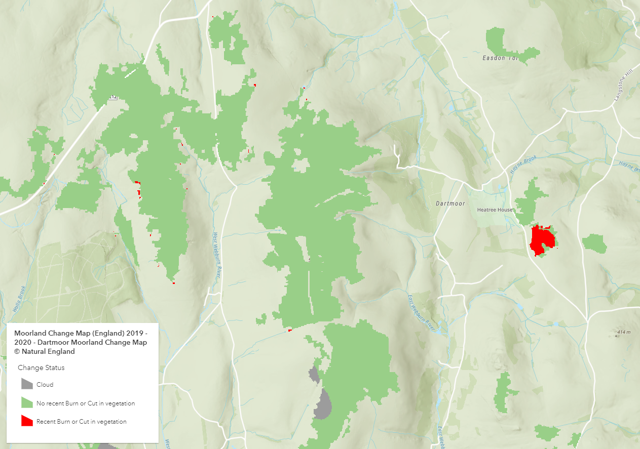
Moorland Change Map (2019-2020) looking at recent burn or cut in vegetation in Dartmoor.
Learn more about Scotland’s natural environment with NatureScot
NatureScot is a public body responsible for Scotland’s natural heritage and is a new Scottish contributor in Living Atlas. They have shared five of their protected areas boundary datasets and their Priority Peatland layer.
The protected areas highlight and preserve Scotland’s most prominent areas of nature including Sites of Special Scientific Interest, National Nature Reserves, Special Areas of Conservation, Special Protection Areas and Ramsar. Whilst the Priority Peatland layer identifies carbon-rich soil, deep peat and priority peatland habitats that are of high conservation value and/or restoration potential.
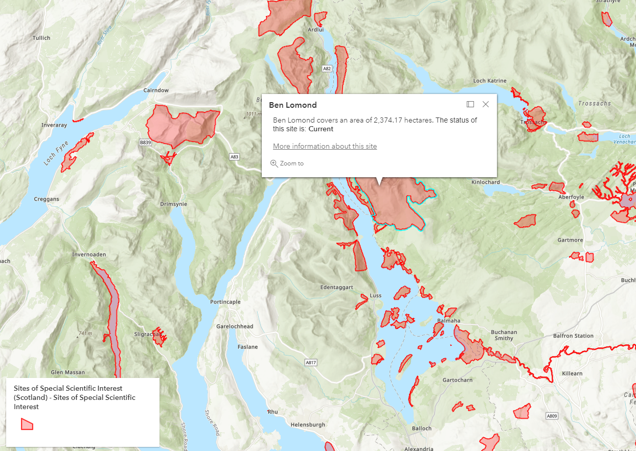
Highlighting Ben Lomond in Scotland which is a Site of Special Scientific Interest.
These datasets can be useful for environmental planning applications and to encourage the preservation of these ecologically important sites. Check out my Living Atlas session from Esri UK’s Scottish Conference where I use the National Nature Reserves dataset to answer: ‘What sites of national importance might be at risk of human-induced land cover change?’.
Cadw – a new Welsh contributor
Cadw look after the historic environment in Wales and have shared their World Heritage Sites and The Registered Landscapes of Outstanding and Special Interest datasets.
World Heritage Sites are UNESCO designated landscapes that are believed to have outstanding universal value. Whilst The Registered Landscapes of Outstanding and Special Interest highlights the most important and significant historic landscape areas. Both datasets are important to raise awareness of these historically and culturally important Welsh landscapes to encourage their conservation in the future.
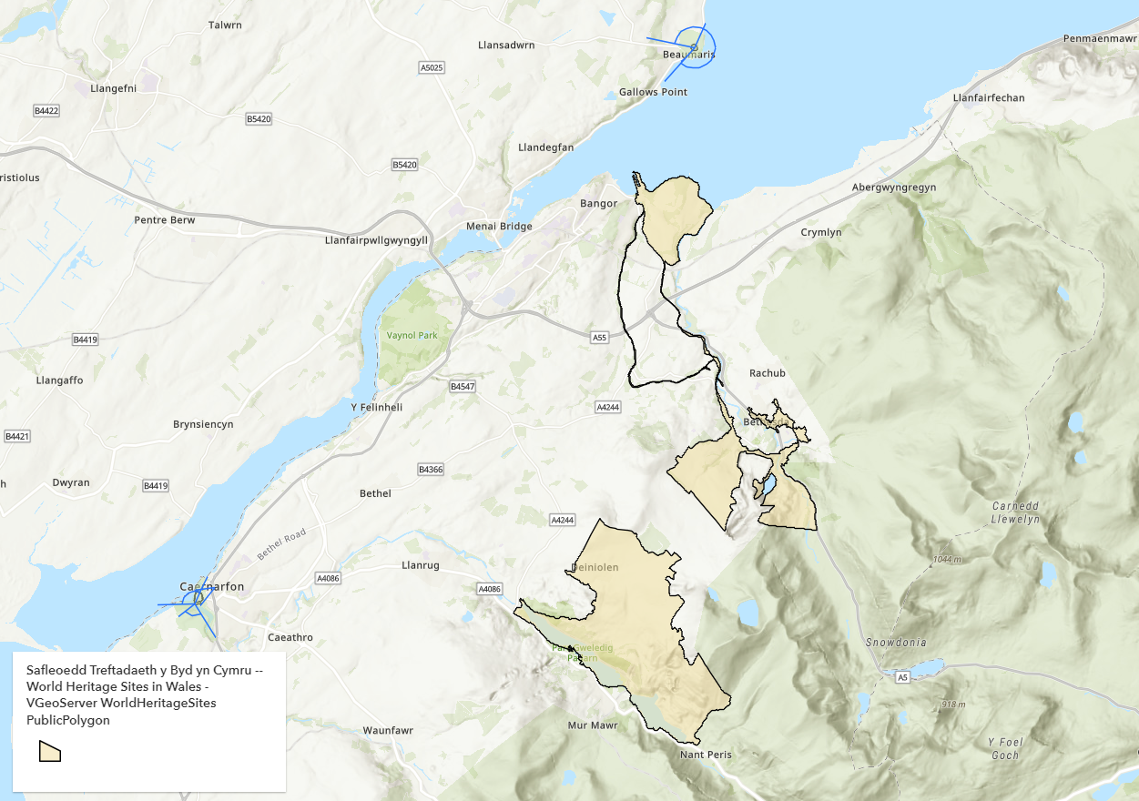
Cadw’s World Heritage Sites for Wales available in Living Atlas.
Watch my Living Atlas session from Esri UK’s Welsh Conference to find out how I use the World Heritage Site dataset to answer important questions like: ‘Which world heritage sites might be at risk of human-induced land cover change?’
Find out which heritage sites are at risk with Historic England
Historic England have also published the latest update of their Heritage at Risk register which shows the overall state of England’s heritage assets for 2021. The register helps to identify sites which are most at risk and in need of safeguarding. Investing in the care of these heritage sites could have economic and cultural benefits, use this dataset to find out sites at risk near you.
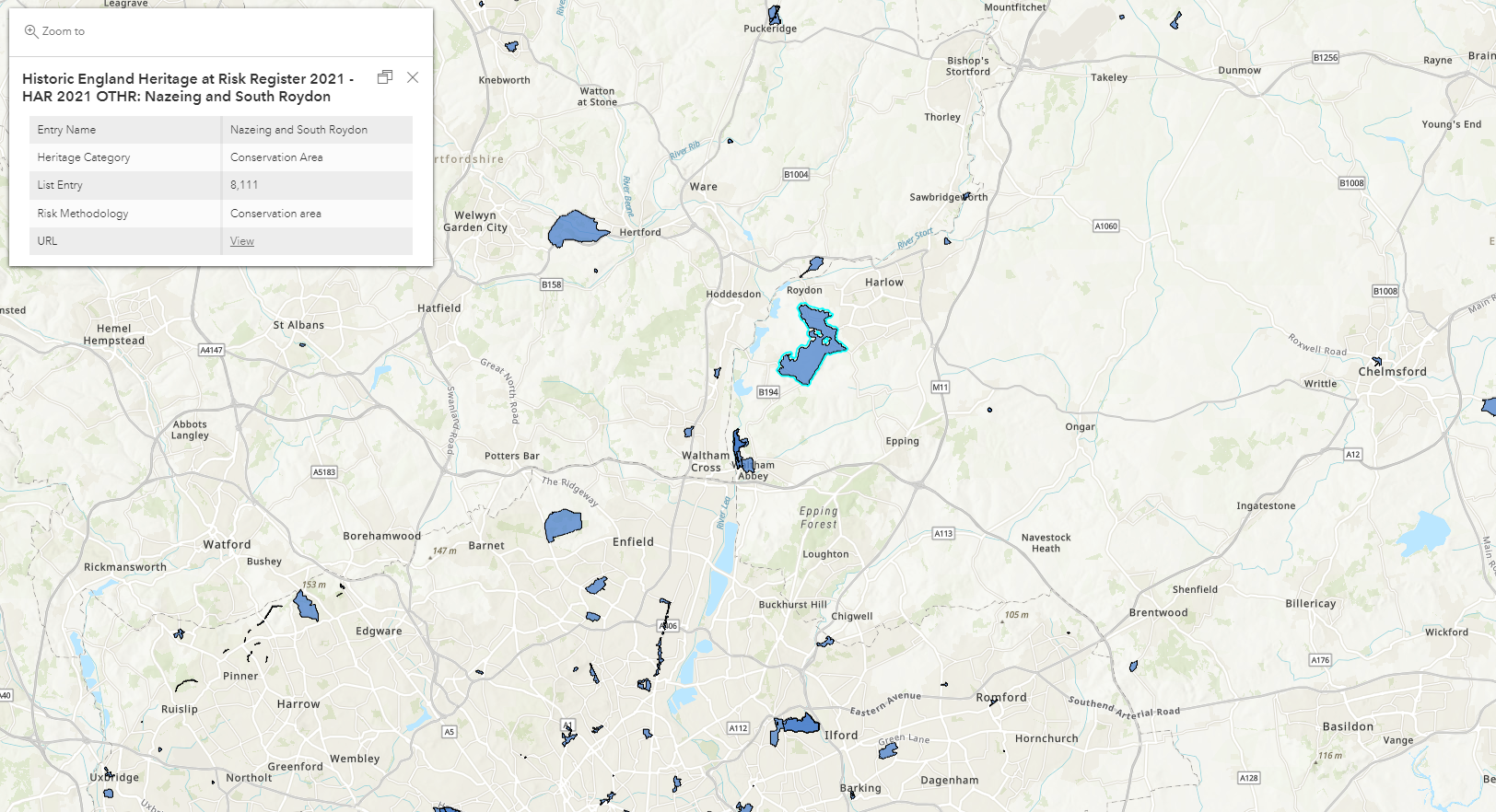
Nazeing and South Roydon conservation area at risk according to Historic England’s Heritage at Risk Register 2021.
People
Find out more about deprivation, urban and rural communities and how the NHS health boards are organised in Scotland
We welcome another new Scottish contributor to Living Atlas – The Scottish Government who have shared three of their datasets.
First is the Scottish Index of Multiple Deprivation (SIMD) 2020. This is the official tool for identifying concentration of deprivation in Scotland. It combines seven domains of deprivation including: income, employment, health, education, crime, access to services and housing. Second, we have the Urban Rural classification which is the official tool for identifying urban and rural communities in Scotland. Third, NHS Health Boards (Scotland) details the 14 regional boards responsible for the delivery of frontline healthcare services.
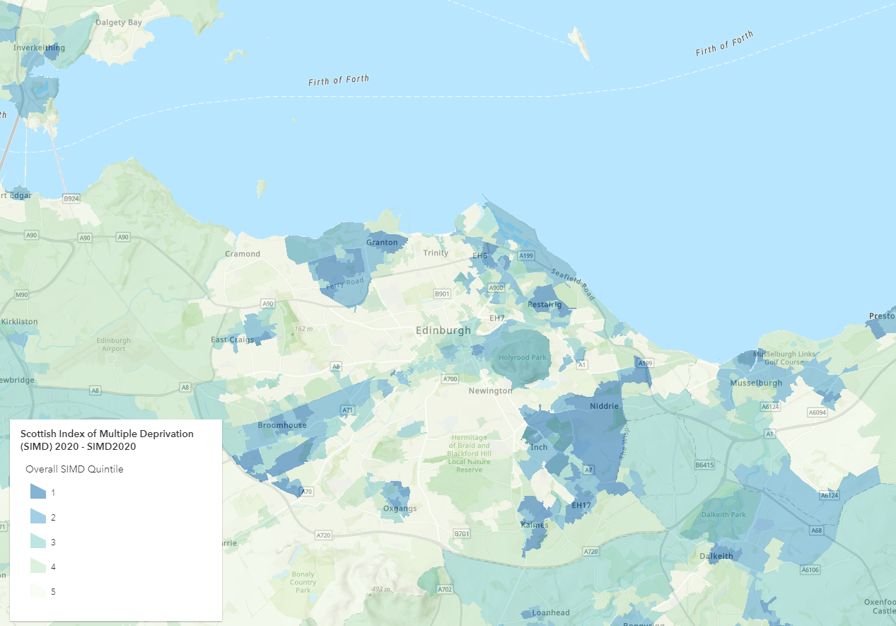
The Scottish Government’s SIMD 2020 showing SIMD Quintile in Edinburgh.
These services can be used to understand the issues facing Scottish communities and can assist in policy development and funding.
Living Atlas Updates
Updates to Office for National Statistics Mid-Year Population Estimates
The Office for National Statistics Mid-Year Population Estimates services in Living Atlas have now been updated to include 2020 data.
Gain insight into demographic trends and answer questions like: “Where is the young and ageing population?” “How has the population changed over the last 5 years?” You can see this dataset in action in my Living Atlas session in Esri UK’s Welsh Conference.
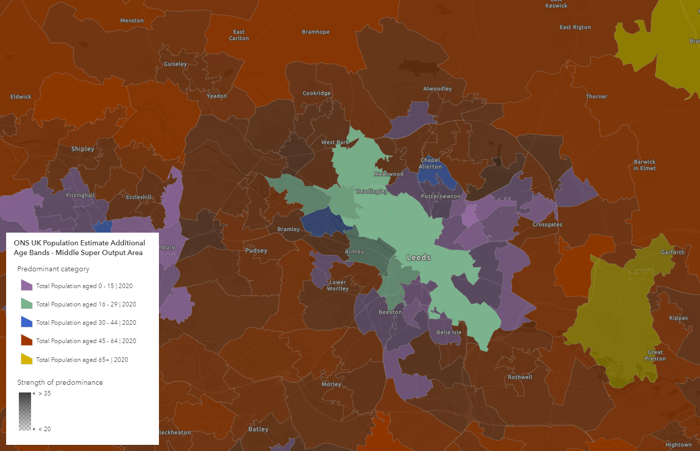
ONS mid-year population estimates predominant age bands in Leeds (MSOA geography).
Updates to Ordnance Survey Open data services
All Ordnance Survey Open data services have now been updated so the currency is October 2021. This service updates includes OS Open Rivers, Roads, Boundary-Line and OS OpenMap Local Buildings and Functional Sites.
OS Open Roads shows the road networks for Great Britain. OS Open Boundary-Line displays administrative and electoral boundaries for Great Britain. OS Open Rivers is a generalised open water network showing the flow and locations of watercourses and water bodies in Great Britain. Check out this blog which uses OS Open Rivers data to explore the UK’s longest rivers.
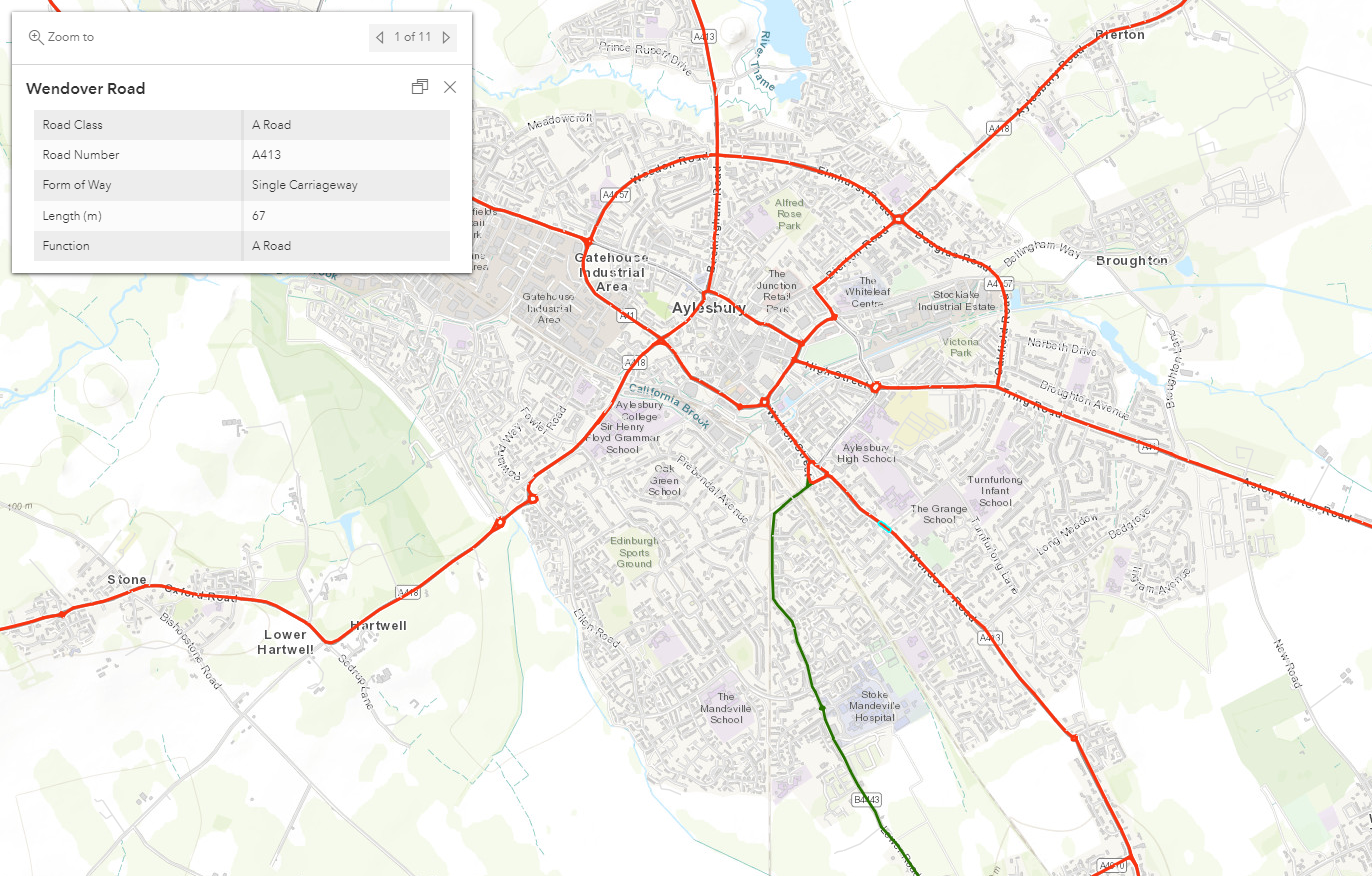
OS Open Roads showing the road network around Aylesbury.
OS OpenMap Local Buildings and Functional Sites are services which highlight the location and extent of buildings/functional sites in Great Britain. These feature services can help users analyse data in relation to these sites. Read more about other use cases for these datasets in our blog.
OpenStreetMap in Living Atlas
For many years, Esri made OpenStreetMap (OSM) data available in ArcGIS Online. This ArcGIS StoryMap resource has been created to reflect the latest updates of OSM in the ArcGIS system. Esri are putting an increasing focus on making OSM more accessible for ArcGIS users and improving the data on there. Explore the resource to find out more about OSM data in the ArcGIS system, how to extract data, applications and how to contribute to the community.
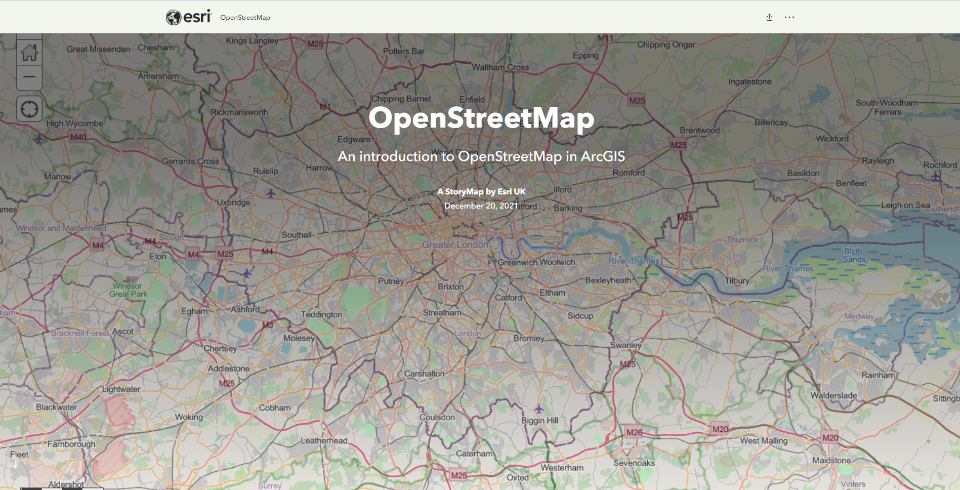
OpenStreetMap StoryMap resource
Help us enrich our Living Atlas!
If your organisation has authoritative datasets that would be a valuable addition to the platform, contribute them to Living Atlas and you too can be featured in this blog. Find out how in this StoryMap.
For any ArcGIS Living Atlas queries, please get in touch with DataCurator@esriuk.com.
Now you’re up to date…
Why not visit the ArcGIS Living Atlas of the World to explore the thousands of authoritative content at your fingertips?
To keep up to date with other ArcGIS Living Atlas news, check out Esri’s blog and follow our dedicated Twitter account. Join Esri Community to connect with other ArcGIS Living Atlas users and share ideas, solutions and collaborate to solve problems with GIS.