Meet the needs of vulnerable people
Voluntary groups, local authorities and healthcare organisations urgently need to pinpoint the locations of vulnerable people within communities and then match them with the nearest volunteers who are available to help them or support services. One of the world’s largest humanitarian organisations, American Red Cross, uses ArcGIS to identify the locations of people displaced from their homes following storms and floods, on interactive digital maps. It can then direct emergency food and medical supplies to the right locations as quickly as possible. Teams working hard to reduce fatalities from COVID-19 can use ArcGIS in the same way to create an interactive map of vulnerable people and ensure they receive the best possible support to keep them safe.
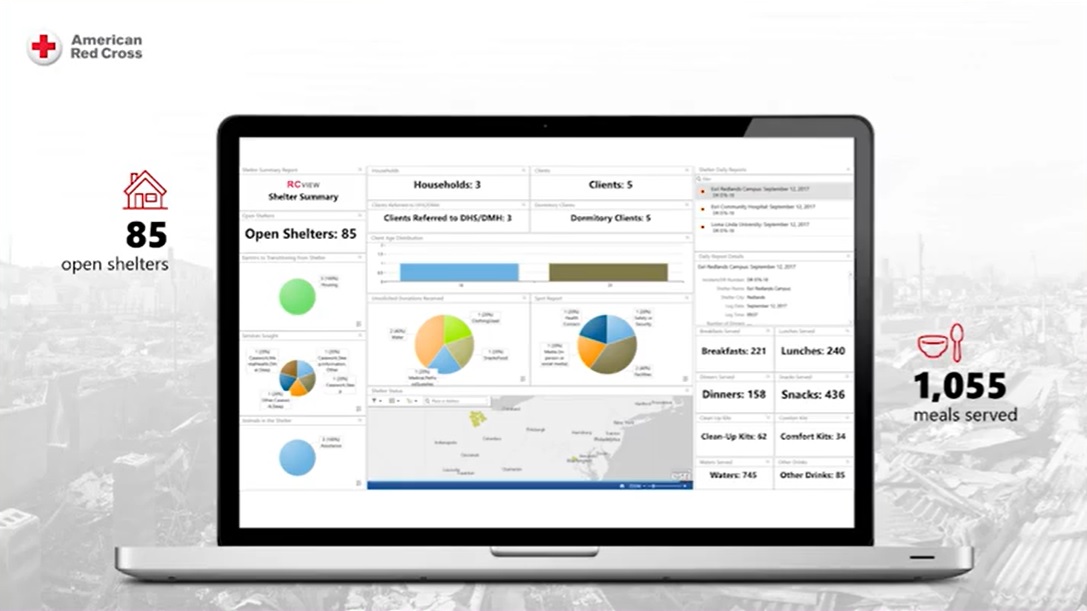
See the American Red Cross presentation from the Esri UK Annual Conference 2019.
Monitor the rapidly evolving situation
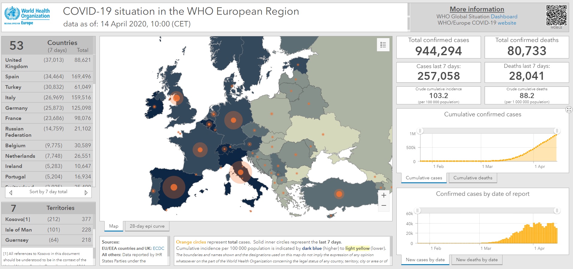
Every day, there are new COVID-19 cases, in different locations, fresh requests for help from the vulnerable and, sadly, additional deaths. ArcGIS provides a way for people to monitor this rapidly evolving situation on interactive maps, so that health advice, volunteer-led support services and emergency care can be directed to the right places, at the right time. Esri ArcGIS Dashboards, like those currently used by large utility companies to respond to emergency call outs, can be quickly set up, providing local authorities, healthcare trusts and voluntary organisations with a real-time overview of the crisis and the insight they need to make rapid, well-informed decisions.
 With every day that passes, the challenges relating to COVID-19 are multiplying. The challenges above will not be the only ones that society needs to resolve and no one can truly anticipate what will happen next. However, ArcGIS has the versatility to help all kinds of voluntary groups, public and private sector organisations, the armed forces and government to gain a better understanding of people at risk, the spread of the disease, the locations of support services and the priority need for resources. It’s ready to go, straight from the box, and it’s free in this crisis. So all you need is a little ingenuity to discover how it can help you and others to make the best possible decisions and safeguard lives.
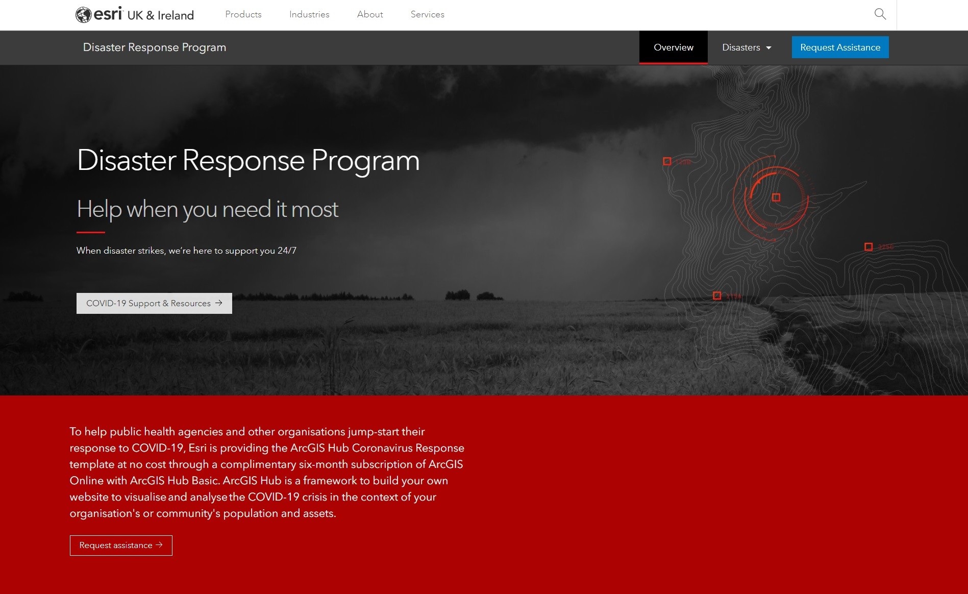
To learn more about the resources available to support your response to COVID 19 please visit out website where you can register for free software. https://www.esriuk.com/en-gb/covid-19/overview
 Miles Gabriel - Esri UK
Miles Gabriel is currently leading Esri UK’s COVID-19 Disaster Response Programme. He is a passionate geospatial data specialist who focuses on helping customers realise the benefits that geography and location can bring to all aspects of their business.