I was recently reading our blog about ArcGIS for Excel and went on a deep dive into how we can integrate spatial visualisation with our everyday workflows in Microsoft applications. Along with new tools, comes access to your existing ArcGIS data and ArcGIS Living Atlas of the World.
ArcGIS for Microsoft 365 is a suite of apps that bridge the gap between the ArcGIS system and Microsoft business applications, including Excel, Power BI, Power Automate, SharePoint, and Teams. In this blog, I’ll delve into the core functionality and capabilities of each product, along with providing links to existing resources. Additionally, I’ll highlight the often misunderstood capabilities of ArcGIS for SharePoint and ArcGIS for Teams.
Pre-Requisites
Before we dive into the world of 365 let’s make sure you can access everything, and not be stuck in a boat without a rudder, or ArcGIS Online with the wrong user type.
To use all features of ArcGIS for Microsoft 365, you must have an ArcGIS account with a Creator licence. This will enable you to view and edit data and create or modify apps and items. However, if you just wish to view content you can use a Viewer licence. For more information do check out the Comparison Matrix and our blog outlining the updates to Users.
Excel
Are you an excel no-mouse pro and know all the shortcuts, but want to quickly visualise your data into a map? With the ArcGIS for Excel add on, you never have to leave Excel but can bring the Esri magic to your spreadsheets. The add on also enables Excel functions for converting latitude and longitude to an address or, my personal favourite, get enriched demographic information about the people, places, and businesses in a specific area distance or drive time from the ArcGIS.ENRICHBYGEOGRAPHY() function.
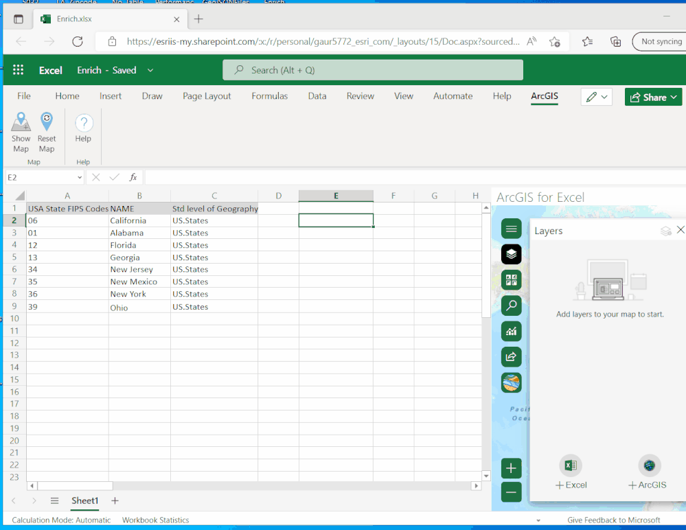
To delve deeper into ArcGIS for Excel, consider checking out our blog Mapping your Spreadsheets with ArcGIS for Excel, learn more about functions through Introduction to ArcGIS for Excel functions, read the documentation or watch an overview video.
Power Automate
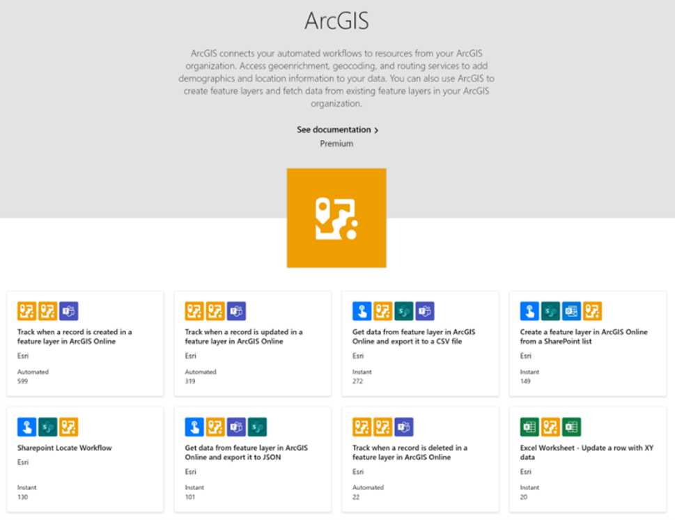
Do you currently use Power Automate to automate tasks within the Microsoft ecosystem? ArcGIS Connectors for Power Automate provides the link from your Microsoft Power Automate workflows to services in your ArcGIS Organization. If you have never heard of Power Automate before it is a service that allows you to automate workflows between different applications for example automating data entry, to automating customer emails.
Key Features of ArcGIS for Power Automate:
- Geocode addresses in a list or database based on triggers or schedules.
- Enrich data by adding demographic information about a location or area.
- Update feature layers in your ArcGIS Organization based on triggers or schedules.
- Retrieve and upload attachments to other external systems such as Dynamics 365 and Dataverse.
For more information be sure to check out our blog for Getting to grips with ArcGIS Connectors for Power Automate. Or a webinar looking at Power Automate and Survey 123.
Power BI
Is Power BI your go to dashboard creator? Do you want to spice up charts and infographics with Maps?
ArcGIS for Power BI is a custom tool within Power BI that brings mapping capabilities to your reports and dashboards. Once you have made the dashboard you can share it with your colleagues. Dashboards can be shared to the public, just watch out as some ArcGIS Living Atlas content does require a valid ArcGIS account.
Key Features of ArcGIS for Power BI:
- Accurately geoenable data.
- Display data using smart map styles.
- Make area-based selections.
- Understand the demographics of areas of interest.
Want to learn more about ArcGIS for Power BI? Check out our dedicated blog How to use ArcGIS with Power BI or dive straight into the Documentation.
Teams

Is Teams your go-to collaboration application, for communication, meetings, file and app sharing? With ArcGIS for Teams, you can bring the power of maps and location-based analytics to your Teams channels and chats. Users can access their ArcGIS content and ArcGIS Organization where everyday conversations are happening.
To get started, you need to add the ArcGIS app to your Teams environment. Once added, you can share maps, scenes, apps, layers, and other items from ArcGIS directly within Teams. You can also search for and share public ArcGIS content.
Key Features of ArcGIS for Teams:
- Share and Discuss Maps: lets you share maps from ArcGIS directly in Teams channels or chats, fostering discussion and collaboration around spatial data.
- Embed ArcGIS Dashboards: to monitor data and make data-driven decisions collaboratively.
- Location-Based Collaboration: helps collaboration on location-based projects by sharing and discussing ArcGIS content.
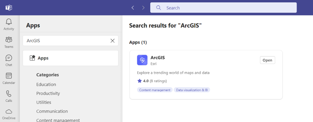
ArcGIS for Teams is available in the Microsoft Store, and for more information check out the dedicated blog Introducing ArcGIS for Teams or a walkthrough video.
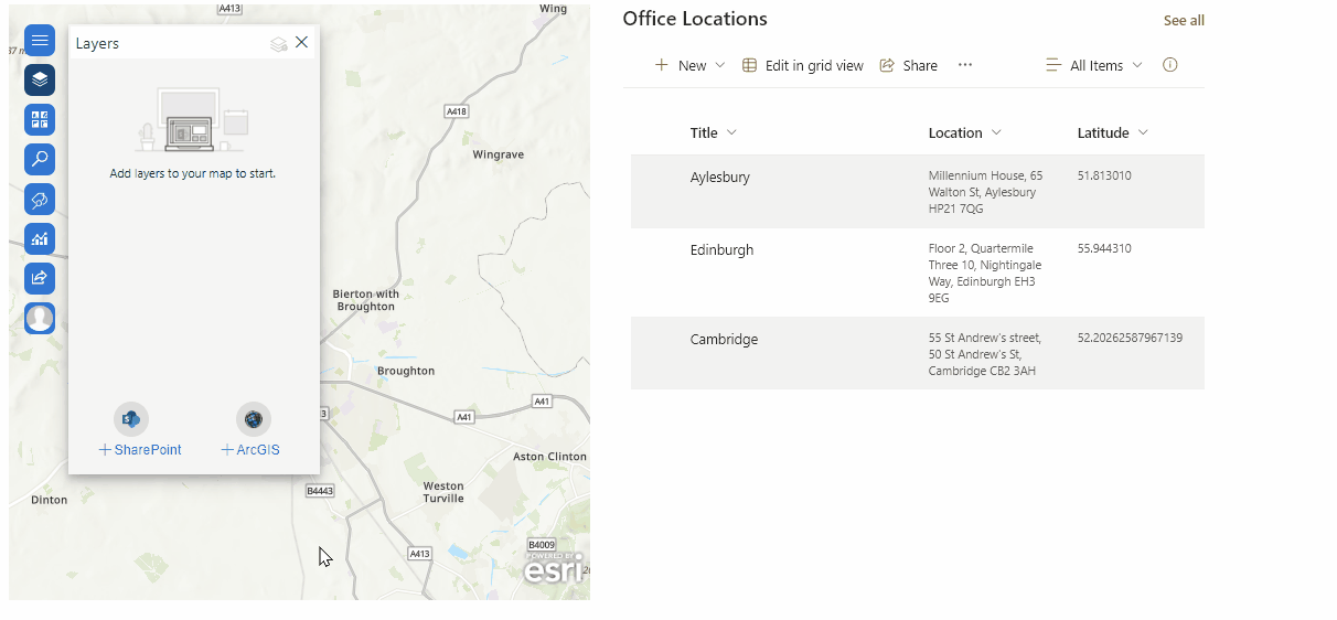
SharePoint
SharePoint is a tool that helps you make and share content, apps, and knowledge. ArcGIS Maps for SharePoint enables you to map, visualise, and analyse data within Microsoft SharePoint. It provides a set of mapping and spatial analytics capabilities that bring visual location intelligence to your business data. With ArcGIS Maps for SharePoint, you can expose the geographic location and relationships of your data, supporting decision making through uncovering patterns and trends.
One of my favourite features within the Map Viewer in SharePoint is to perform drive time analysis of your data from a click of a button. To find out more, check out the workflow Create a Buffer/Drive time analysis layer.
Key Features of ArcGIS for SharePoint :
- Add interactive maps to a SharePoint page.
- Add location-based lists or ArcGIS content to maps.
- Add context and precision to location-based lists with Esri demographics data.
- Share maps and layers from ArcGIS with the public or with your ArcGIS Organization.
- Locate your SharePoint content using location attributes by geotagging and geosearching.
Are you interested in learning more? Check a Demonstration video or find out how the United States Marines use ArcGIS for SharePoint.
Conclusion
Using ArcGIS for Microsoft 365 has changed the game for me. It’s made my work smoother, teamwork better, and spatial analysis a breeze. Whether you’re working with Excel, automating tasks with Power Automate, or collaborating with your team on SharePoint most of the actions in ArcGIS for Microsoft 365 use no credits, geocoding is the main exception but check this article for the details.
So why wait? Dive in and explore the world of spatial analysis in Microsoft 365 today!