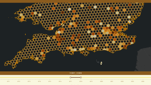
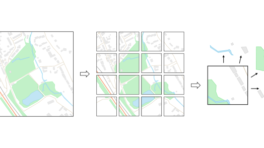
Blog Esri UK Tech Blog CategorySelect3DCartographyContentData ManagementDeveloperMobileProduct NewsSpatial AnalysisTipsTechnologySelectAppsArcadeArcGIS EnterpriseArcGIS Living AtlasArcGIS OnlineArcGIS ProArcGIS StoryMapsDevelopersMobileSweet for ArcGISUK ProductsUtility Network EditorSearch Tips Arcade unscripted: thoughts from a newbie 11th January 2023 You’ve spent the past few hours creating a map in ArcGIS Online. It’s fine. It does the job, but you know that there’s room for improvement. If only your organisation’s branding scheme could be integrated into the map. Or, if … Read more Product News Follow your tracks; Location sharing in ArcGIS 21st December 2022 Data collection is easier than ever thanks to technology which allows users to carry out operations both in office or out and about. But how can organisations ensure their workers safety and maximise efficiency? Enter, location sharing. If this is... Read more Tips Let your work flow with tasks in ArcGIS Pro 16th December 2022 While I was creating my Electric Vehicle charge maps, I realised that I had developed a workflow in ArcGIS Pro that could be repeated for any highway in Britain. A colleague suggested that I try recording and sharing my workflow … Read more Content Explore the 2021 Census data with ArcGIS Living Atlas 14th December 2022 Back in 2021, many of us in England and Wales may remember filling in the many pages of the census. Since then, much of the data has been processed by the Office for National Statistics and is starting to become … Read more Tips Cartographic representations in ArcGIS Pro 21st November 2022 Many of you will have made the switch from ArcMap to ArcGIS Pro already, but you may still need to move ArcMap content to the new ArcGIS Pro projects. So – what needs to happen if you want to start … Read more Cartography Mapping 100 years of precipitation 18th November 2022 In the UK, the 10 hottest years on record have all been since 2002 and in the summer of 2022, July and August were the warmest ever. Despite periods of rainfall, hosepipe bans were put in place across large areas … Read more Content Important Update for Office for National Statistics Datasets in ArcGIS Living Atlas 14th November 2022 The Office for National Statistics (ONS) are currently undergoing migration of their feature layers to ArcGIS Online. ONS services in the Living Atlas will be removed and replaced with new services. Read on to find out how it might affect …... Read more Spatial Analysis Taking a spatial-first approach to the location of assets 3rd November 2022 In this blog post I’ll discuss the relative benefits of linear referencing and spatial referencing. I’ll cover where each can have its place, which should be considered the master, and why. What is linear referencing? In many industries such as &h... Read more Tips From project to paper: printing in the ArcGIS System 3rd November 2022 The world is becoming more and more digital. We’re no strangers to it at Esri UK, providing ways for people to create interactive apps, maps and websites that don’t quite have the same effect when printed onto traditional, static paper. … <... Read more Content Your Living Atlas Autumn Roundup 18th October 2022 For this Q3 update, we have welcomed 26 new datasets and 3 new contributors to Living Atlas – Met Office, Rural Payments Agency and Digital Health and Care Wales! As of today, UK Living Atlas has 632 items and 57 … Read more Cartography Watermarkr your map 7th October 2022 With the retirement of Markr coming ever closer, you may be wondering “how can I add watermarks to my map?”. The answer is simple: all you need is an awesome logo in SVG format, a coverage layer in the coordinate … Read more Content OS Vector Tile API within ArcGIS 5th October 2022 You have been asking for a while how to use Ordnance Survey’s Vector Tile API within ArcGIS. Whilst it has always been possible to use them in applications you build with the ArcGIS APIs and SDKs, some recent updates to … Read more Pages: 12345678910111213141516171819202122Load More