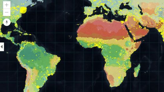
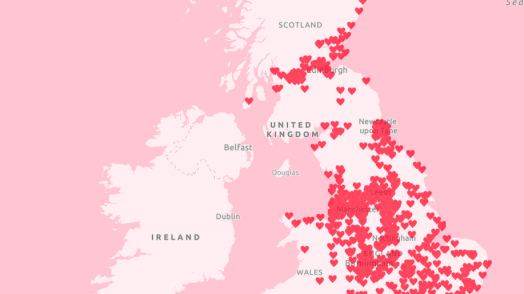
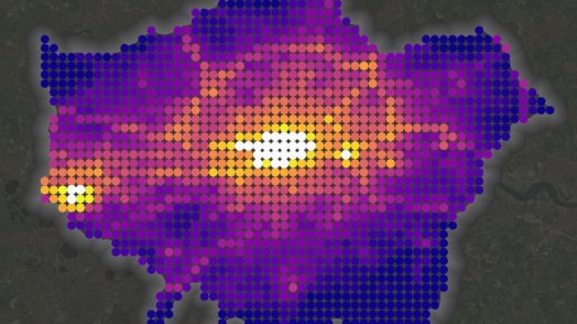
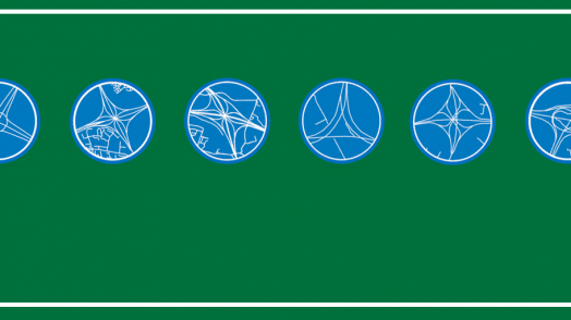
Blog Esri UK Tech Blog CategorySelect-- Select Category --3DCartographyContentData ManagementDeveloperMobileProduct NewsSpatial AnalysisTipsTechnologySelect-- Select Technology --AppsArcadeArcGIS EnterpriseArcGIS Experience BuilderArcGIS Living AtlasArcGIS OnlineArcGIS ProArcGIS StoryMapsDevelopersMobileReport Builder for ArcGISSweet for ArcGISUK ProductsUNE for ArcGISSearch Product News ArcGIS Enterprise 10.7 27th March 2019 ArcGIS Enterprise 10.7 is now available. It brings a raft of updates to Portal as well as new options for publishing and managing services. One of the biggest changes is the introduction of User Types, which provid... Read more Product News The ArcGIS Online spring update has sprung 20th March 2019 The March 2019 update of ArcGIS Online introduces an innovative new app template and the ability to quickly turn geotagged photos into a map layer. But of course, that’s not all. Read more Data Management How to do polygon Red-Lining and T-Markers in ArcGIS Pro 13th March 2019 In this case red-lining is the process of inserting a red-line to the inside boundary of a land parcel, while T-marking is used to indicate boundary responsibility or ownership. ProductivitySuite is set to ret... Read more Content Interact with the Earth Systems Monitor 28th February 2019 Want to explore a variety of environmental and socio-economic data? With the Earth Systems Monitor app, you can. Come and take a look. Read more Data Management Creating ArcGIS Online layers from scratch 22nd February 2019 There are a few different ways to create a feature layer in ArcGIS Online. Did you know that you can create one from scratch or by using a template? Read more Cartography Where is the love? – Valentine’s Day Cartography 15th February 2019 Did you see our romantically-themed Valentine’s map? Read on to find out how we made it. Read more Content Explore OpenStreetMap in ArcGIS 13th February 2019 OpenStreetMap is one of the biggest collaborative mapping projects out there. A community of mapping enthusiasts have helped to contribute over 4 billion points of information since its initial creation in 2004. Op... Read more Cartography How clean is the air you breathe? 1st February 2019 Over 8 million people live in Greater London with roughly 11.9 million vehicles travelling their road’s in 2017. That’s a lot of vehicles emitting and a lot of people breathing. In the wake of the government’s new ... Read more Content Increase your content’s exposure with Verification and Authoritative Content 29th January 2019 Many organisations use ArcGIS Online to share their most authoritative content with their communities. Subsequently, ArcGIS Online now includes millions of items from thousands of organisations worldwide and is co... Read more Product News New features and more in ArcGIS Pro 2.3 25th January 2019 The latest update for ArcGIS Pro has now arrived and I’ve counted over 75 new features! I’ve taken a look at some of the changes to introduce you to what’s new in ArcGIS Pro 2.3. Read more Cartography Keeping it Simple: Road Layouts in ArcGIS Pro Layout 17th January 2019 Want to know how to create custom maps with ArcGIS Pro Layout? Or just find out where the other most complex road junctions across England are? Read more Content Focus on: Imagery 9th January 2019 Imagery is powerful. It can help us turn data into information, information into decisions and decisions into action. The new Esri UK story map will help you learn about image... Read more Pages: 123456789101112131415161718192021222324252627Load More