Tag Archives: Apps
Bring temporal data to life with the ArcGIS Instant Apps Slider template
Need to animate data based on numeric values or time intervals? The Slider template in ArcGIS Instant Apps is a perfect way to do this. It’s ideal for displaying historical, live, or even future data. Users can interact with the … Continue reading
Continue ReadingRecording multiple geometries in one survey with ArcGIS Survey123
Maybe you work for a national park and need to collect data on trees, bushes, hedges, and terrains throughout the park. Or maybe you work at a school and want to record geometries of fences and playing fields around the … Continue reading
Continue ReadingArcGIS licensing in six user type choices
This blog was updated in March 2025 to reflect new changes coming to the user types. The ArcGIS system contains a diverse portfolio of individual products that meet the wide needs of our customers. From a capability and technology perspective … Continue reading
Continue ReadingIndoors capabilities in the ArcGIS system
From operations to the management of assets, the ability to map indoor spaces opens a plethora of new opportunities and ways to display and understand your spatial data. The concept of indoor mapping is relatively straightforward and if you want … Continue reading
Continue Reading
Analyse and visualise imagery in ArcGIS Online
Updated and republished in August 2024 to reflect changes to the ArcGIS user types. Access to the imagery capabilities in ArcGIS Online has been expanded and they are now available for user types Creator and above (previously an ArcGIS Image … Continue reading
Continue Reading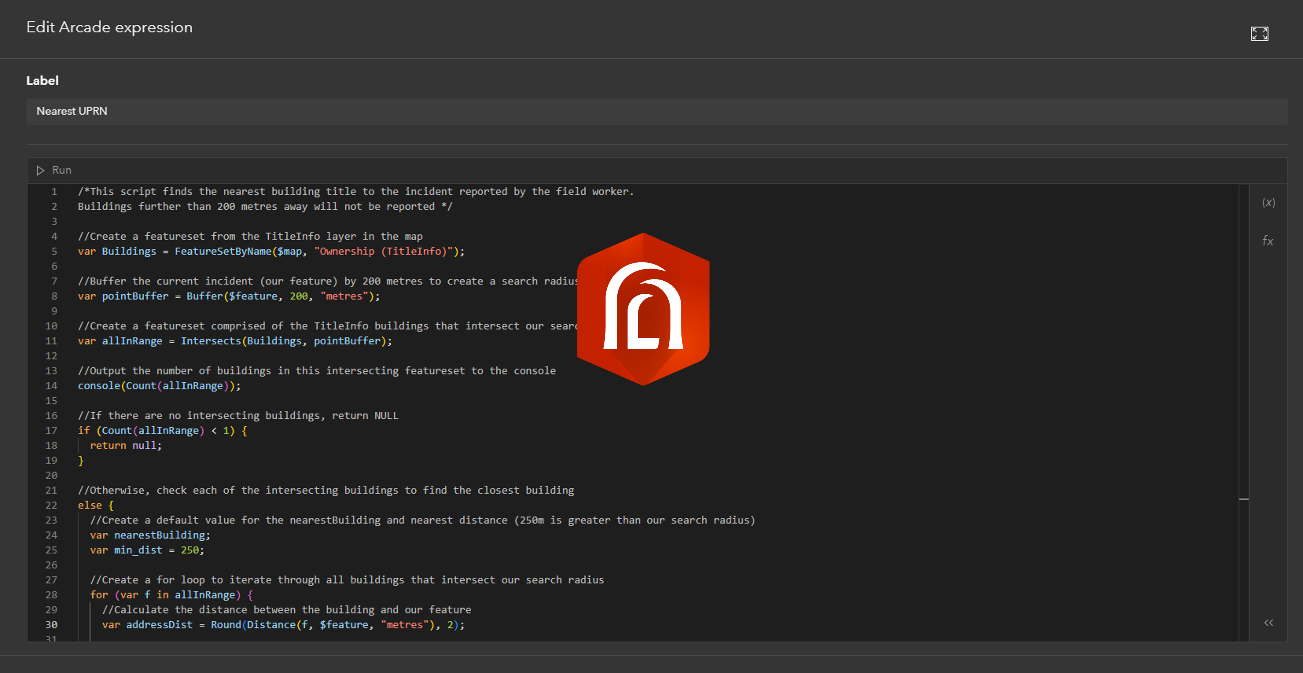
Arcade Keywords: what they are and how to use them in ArcGIS
Arcade is a lightweight expression language for customising your ArcGIS maps and apps. Whether it’s for enhancing your pop-ups, integrating other data layers, performing on-the-fly calculations, or so much more, Arcade is a helpful tool to understand. We’ve already written … Continue reading
Continue ReadingPowerful apps in an instant with ArcGIS Instant Apps
If you’re reading this, I’m going to assume you’ve made a map or two in the past to help visualise your data with geographical context. But what if you want to share this with others so they can interact, better … Continue reading
Continue ReadingRevisiting the ArcGIS Survey123 Web or Connect question
ArcGIS Survey123 is an app dedicated to creating effective surveys for collecting your data quickly and with ease and can be shared with a wide audience. To suit your survey needs, it’s available in two offerings: Survey123 Web for quick … Continue reading
Continue ReadingCollecting data in the field with ArcGIS Field Maps smart forms
Have you ever thought about the most effective way to not only collect, but edit and update spatial data? ArcGIS Field Maps is one of our mobile offerings designed to help mobile workers perform data collection and editing, find assets … Continue reading
Continue Reading
Creating Web Apps with Design in Mind
Beautiful cartography, effective labels, elegant styles – a lot of time and effort goes into creating maps. But we shouldn’t stop at the maps we create. A well thought through app design isn’t just about making something ‘pretty’, it’s about … Continue reading
Continue Reading