Tag Archives: Ordnance Survey
Map Smarter (and Faster) with the OS NGD API
Thanks to work behind the scenes, you can now access features from Ordnance Survey’s National Geographic Database (NGD) directly in ArcGIS Online and ArcGIS Enterprise 11.1 onwards. With the OS NGD API – Features, you can access up-to-date, authoritative OS … Continue reading
Continue Reading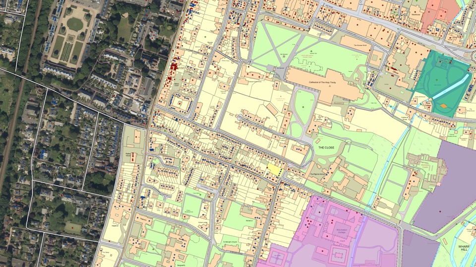
Ordnance Survey
With the ArcGIS System and the exemplar application of Sweet for ArcGIS we have created a lighthouse geospatial platform that is already seeing impactful, measurable benefits.
Continue ReadingOS OpenMap – Local Buildings & Function Sites in the Living Atlas
This month, we are excited to bring OS OpenMap – Local Buildings, Important Buildings and Functional Sites to the Living Atlas! Ordnance Survey® describe OS OpenMap – Local as the most detailed ‘street level’ mapping product available within the open … Continue reading
Continue ReadingConnector for OS Places API
As previously announced, all Public Sector Geospatial Agreement members have now been given access to the OS APIs. One of these is the OS Places API which allows address searching using AddressBase Premium. We have now released the Connector for OS Places API, … Continue reading
Continue ReadingOS APIs for public sector customers
Under the new Public Sector Geospatial Agreement (PSGA), public sector organisations now have access to premium Ordnance Survey (OS) APIs. Read on to find out more about the new services and where you can find further resources to get you … Continue reading
Continue ReadingHow is Esri UK supporting the new Public Sector Geospatial Agreement?
The Government announced a new 10 year Public Sector Geospatial Agreement (PSGA) with Ordnance Survey in April 2020. The PSGA is a replacement for the Public Sector Mapping Agreement (PSMA) and One Scotland Mapping Agreement (OSMA), but goes beyond the … Continue reading Continue Reading
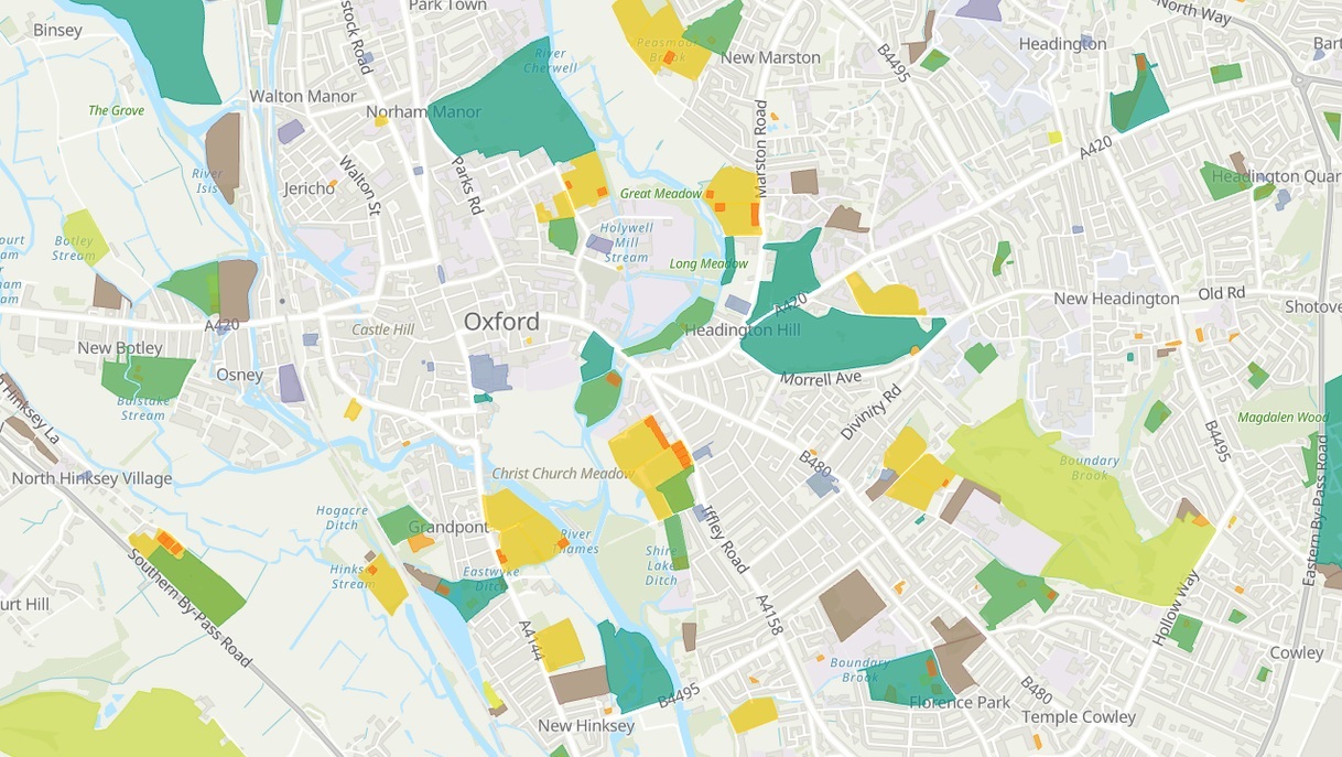
Go Green! – OS Open Greenspace is now in the Living Atlas
Esri UK has been working with the Ordnance Survey to nominate their first dataset into the Living Atlas - OS Open Greespace! Dive into the data and explore a couple of possible use cases…
Continue ReadingViewing OS Zoomstack Data in ArcGIS Pro
See how you can quickly add and style the OS Zoomstack data in ArcGIS Pro.
Continue ReadingAccessing OS Open Zoomstack Vector Tiles in ArcGIS
Building multiscale basemaps can be very challenging when you have to integrate different datasets into a consistent map base. OS have started an Open Zoomstack trial to explore ways to make this easier. One of the options available is a vector tile service and a set of styling options to accompany this. Read on to discover how to make use of this tile service
Continue ReadingOS Open Data Vector Tiles are here!
We are pleased to announce the launch of our OS Open Data basemaps as vector tile services.
Continue Reading