Tag Archives: ArcGIS
Create pop-ups that perform in ArcGIS Online
Mapping your data tells a visual story. But sometimes it feels like you’re only getting a chapter, or perhaps the first book of a semi-successful trilogy. Trying to present lots of data, or data with many relevant attributes, gets cluttered … Continue reading
Continue Reading
Curious about Game Engines?
As a gamer and geographer, I was curious and excited when I found a way to incorporate my two passions with the ArcGIS Maps SDKs for Unity and Unreal Engine. Through games we can immerse ourselves in virtual worlds, usually … Continue reading
Continue Reading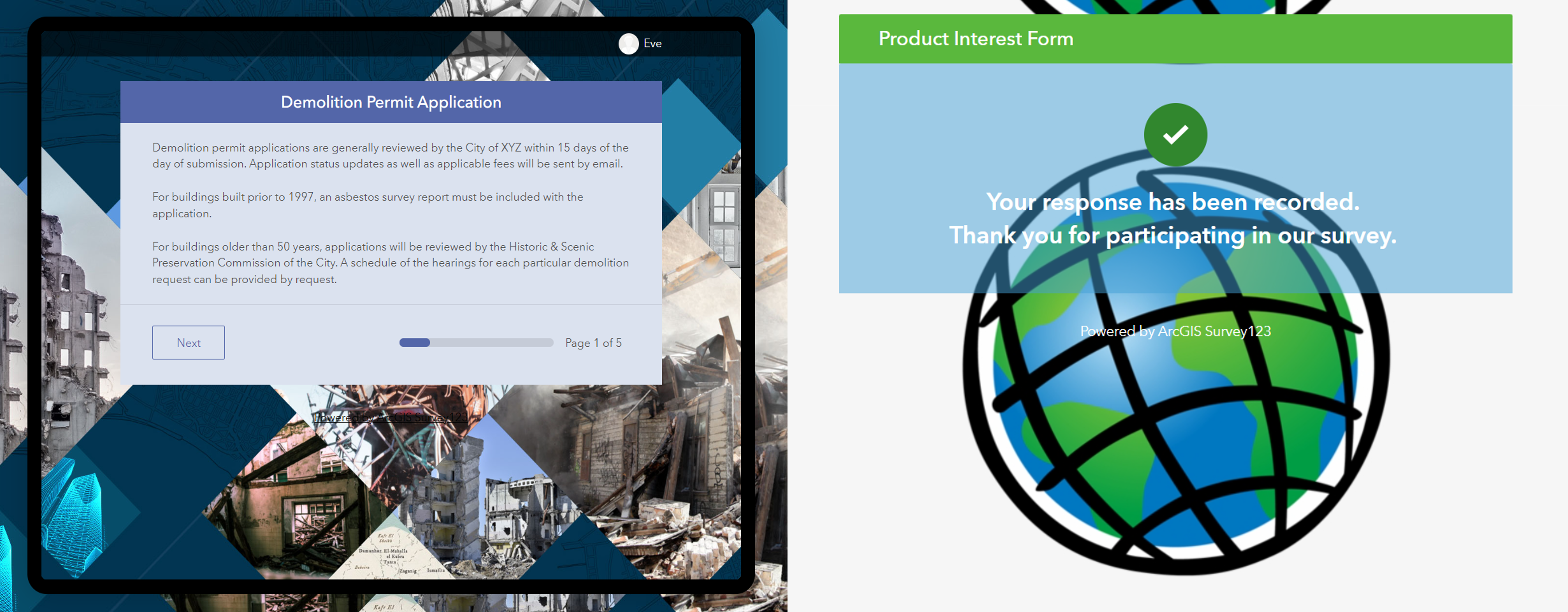
Designing surveys in Survey123: Ditch the default
Building surveys already requires planning to create something that’s easy to fill out for the end user. When you add in the need to brand the form to your organisation’s requirements or factor in efforts to structure it intuitively, it … Continue reading
Continue Reading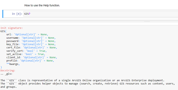
Notes from a Notebooks Beginner
Starting to code can be scary and while there are some learning resources available, they sometimes seem aimed at developers. As a complete beginner, this was a little bit daunting for me. With this blog, I will show you how … Continue reading
Continue Reading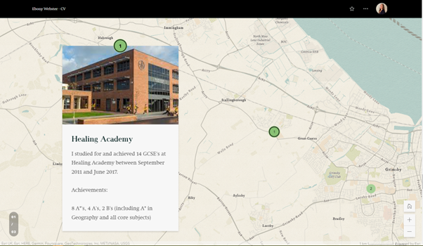
CVs just got a whole lot more interesting with ArcGIS StoryMaps
As employment applications become increasingly digital and technology-focused, jobseekers need to find innovative ways to stand out from the competition. ArcGIS StoryMaps is a web-based platform that allows users to combine maps, multimedia content and storytelling to create engaging stories…or … Continue reading
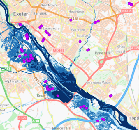
Analysing JBA Flood Maps in ArcGIS
Flooding poses an extreme threat to people’s livelihoods. Heavy rain and storm events cause surrounding rivers and coasts to become inundated with water, bringing a wealth of social, environmental and economic impacts. With floods of greater intensity predicted across much … Continue reading

Ramblers Scotland
ArcGIS Hub Premium is helping us to engage the support of 250 volunteers and share information about Scotland’s 40,000 mile network of walking paths.
Continue Reading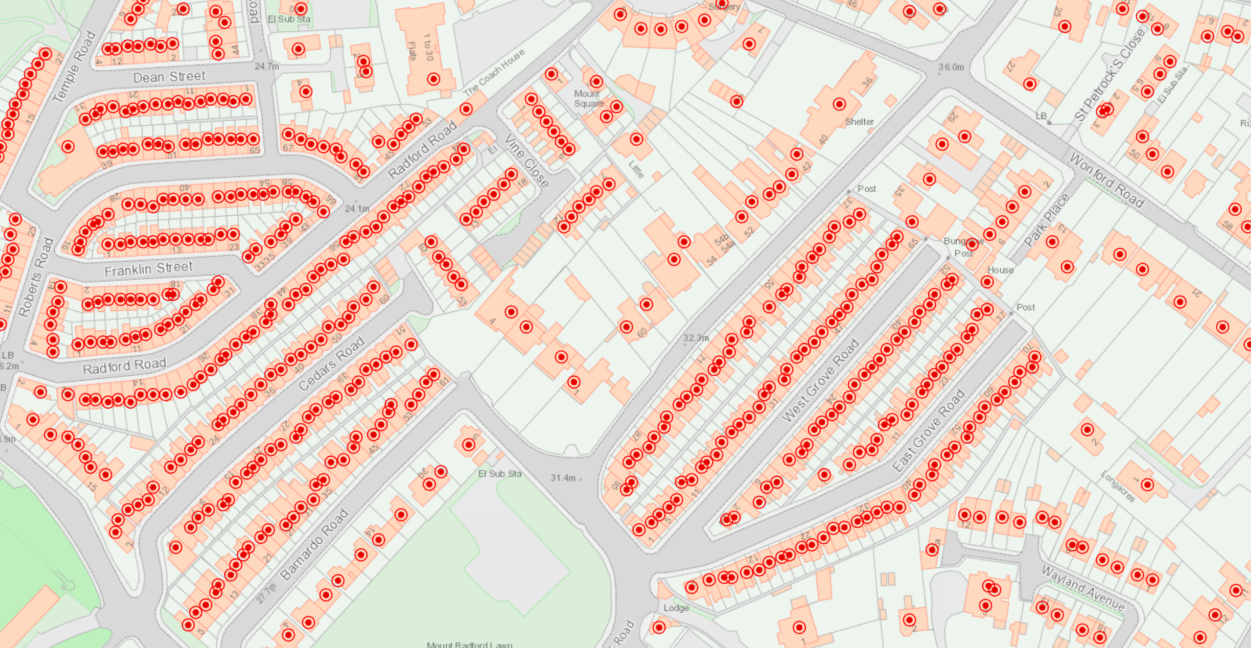
Addressing the benefits of ArcGIS Locators for finding places
Whether you are a locator aficionado or amateur, many of us are all too familiar with the satisfaction that comes from a seamless map-based search; be it by location, address or feature name. From my recent experience working with ArcGIS … Continue reading
Continue ReadingBe part of the ArcGIS development process
To create great technology, it’s critical to understand the people behind its use…us, the users. This is how Esri developers and software engineers create products that tap into what we are looking for. Esri’s user research and testing teams put … Continue reading
Continue Reading
Thirteen Group
Thirteen Group’s Community Resilience strategy works to understand local communities better, inform decisions and signpost customers to the services available.
Continue Reading