Tag Archives: Mobile
Recording multiple geometries in one survey with ArcGIS Survey123
Maybe you work for a national park and need to collect data on trees, bushes, hedges, and terrains throughout the park. Or maybe you work at a school and want to record geometries of fences and playing fields around the … Continue reading
Continue ReadingArcGIS licensing in six user type choices
This blog was updated in March 2025 to reflect new changes coming to the user types. The ArcGIS system contains a diverse portfolio of individual products that meet the wide needs of our customers. From a capability and technology perspective … Continue reading
Continue ReadingRevisiting the ArcGIS Survey123 Web or Connect question
ArcGIS Survey123 is an app dedicated to creating effective surveys for collecting your data quickly and with ease and can be shared with a wide audience. To suit your survey needs, it’s available in two offerings: Survey123 Web for quick … Continue reading
Continue ReadingCollecting data in the field with ArcGIS Field Maps smart forms
Have you ever thought about the most effective way to not only collect, but edit and update spatial data? ArcGIS Field Maps is one of our mobile offerings designed to help mobile workers perform data collection and editing, find assets … Continue reading
Continue Reading
Automating workflows in ArcGIS with our mobile apps
Wouldn’t it be great if you could be alerted when a mobile worker adds, edits or deletes data whilst out in the field? Or how about if a report is automatically created for you to review after your data is … Continue reading
Continue Reading
Getting to grips with ArcGIS Connectors for Power Automate
ArcGIS Survey123 users have had the ability to enhance their workflows through automation for some time now, using connectors available in Power Automate and Make (formally Integromat). If you wanted to configure automated post-capture workflows for your other applications, there … Continue reading
Continue Reading
Designing surveys in Survey123: Ditch the default
Building surveys already requires planning to create something that’s easy to fill out for the end user. When you add in the need to brand the form to your organisation’s requirements or factor in efforts to structure it intuitively, it … Continue reading
Continue ReadingGetting to know the geofencing capabilities in the ArcGIS system
Location is at the heart of everything we do here at Esri UK. So any capability that allows us to get even more from our location data is pretty powerful. And that’s exactly what geofencing is all about. Geo refers … Continue reading
Continue Reading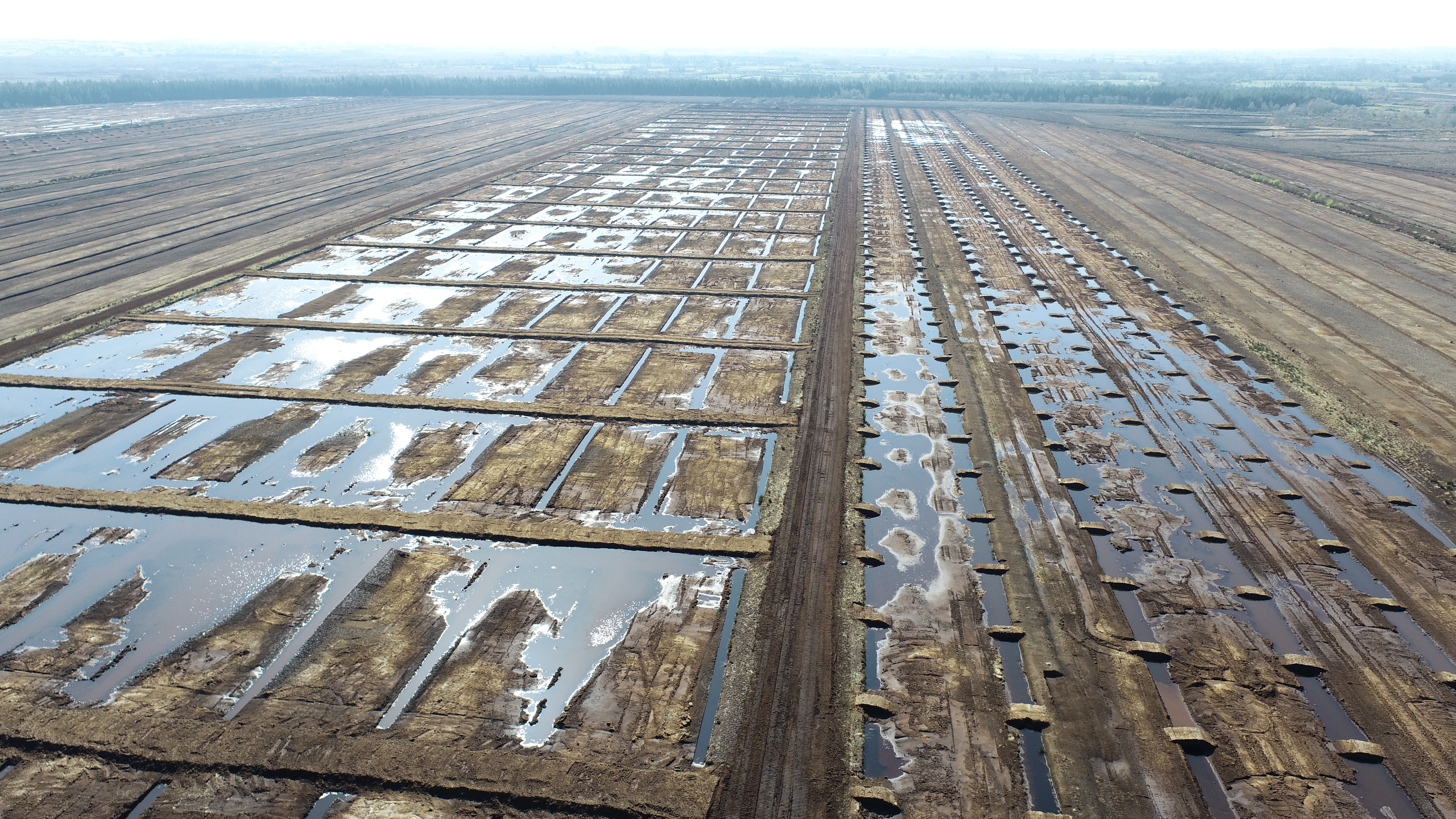
Bord na Móna
We have invested in ArcGIS within the field and on our desktops to inspect contractors' work, track quality control trends and contribute to the success of government energy-saving programmes.
Continue Reading
KSN Energy
We have invested in ArcGIS within the field and on our desktops to inspect contractors' work, track quality control trends and contribute to the success of government energy-saving programmes.
Continue Reading