Tag Archives: Data
ArcGIS field calculations as a novel project progress tracker
The Challenge The London Underground is one of the most extensive metro systems in the world, and the complex nature of the network led to the creation of one of the most well-known topological maps in the world. But… what … Continue reading
Continue ReadingMap Smarter (and Faster) with the OS NGD API
Thanks to work behind the scenes, you can now access features from Ordnance Survey’s National Geographic Database (NGD) directly in ArcGIS Online and ArcGIS Enterprise 11.1 onwards. With the OS NGD API – Features, you can access up-to-date, authoritative OS … Continue reading
Continue Reading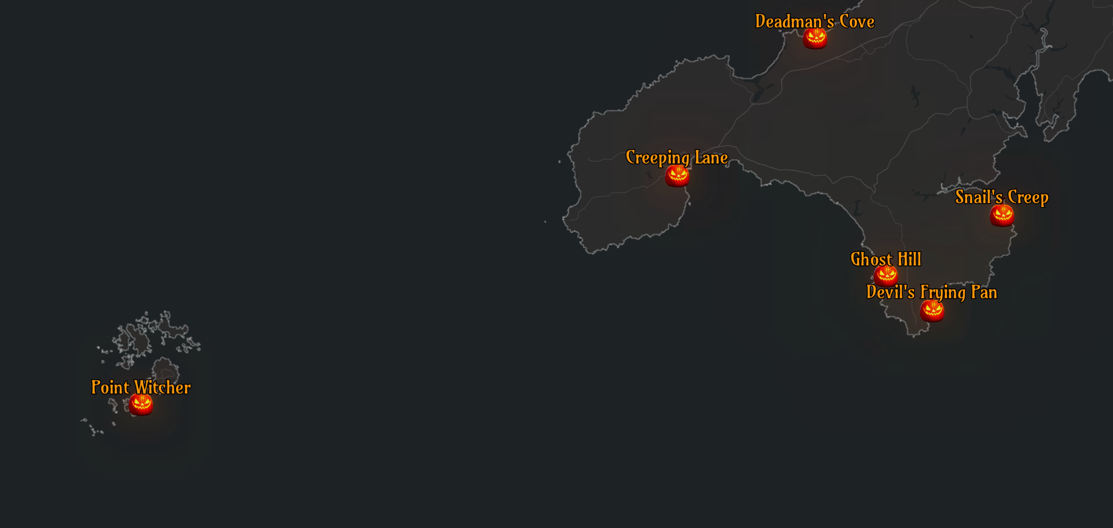
Creating a spooky map with the Living Atlas
Halloween is just around the corner, and what better way to celebrate than with a spooky map? Inspired by the Inferno map by John Nelson, we wanted to produce a scary map that centred on Halloween-related place names. In this … Continue reading
Continue Reading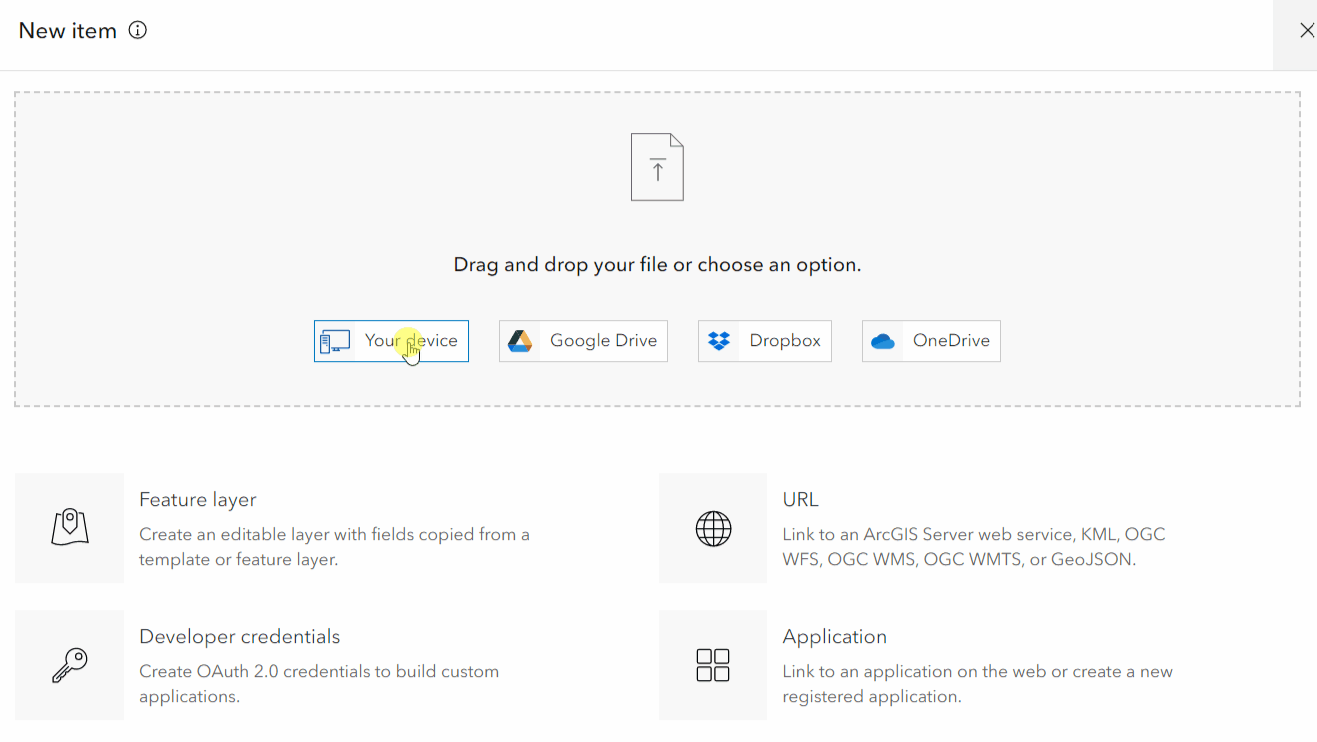
Turn your Excel data into an ArcGIS Online layer
You might ask yourself – but why would I want to do that? The data we use in ArcGIS Online can come from various resources. We might use layers shared by our organisation or from Living Atlas of the World, … Continue reading
Continue ReadingHot off the press: Your ArcGIS Living Atlas of the World summer updates
It’s been a jam-packed last few months for the UK Living Atlas. For this summer update, we have welcomed 134 new datasets and four new contributors including: the British Antarctic Survey, Welsh Government, Marine Scotland (part of the Scottish Government) and … Continue rea
Continue ReadingLand Cover – find out what your city is made of!
The makeup of our cities plays a key role in our day to day lives and how we interact with our environment. To get a better understanding of where we live, we’ll be exploring what land cover our cities consist … Continue reading
Continue ReadingSpring into action with these updates on ArcGIS Living Atlas of the World
The days are brighter, daffodils are blooming which only means one thing – spring has finally sprung! Like the daffodils, ArcGIS Living Atlas of the World is growing. Since our last winter update, there are 28 new UK datasets and … Continue reading
Continue ReadingYour winter update on ArcGIS Living Atlas of the World
What better way to start off the New Year than by catching up with the latest updates in ArcGIS Living Atlas of the World? In the last blog, I shared with you some of the new and noteworthy contributions from … Continue reading
Continue ReadingProcessing Big Data using Small Data techniques
In today’s world, more and more organisations are starting to use Big Data techniques to analyse their data, which is increasing in volume and velocity every day. Cloud providers are both meeting and fuelling demand for these capabilities by providing … Continue reading
Continue Reading
Ricardo
Our migration to ArcGIS Pro is helping us to create and share high quality data sets on air quality and greenhouse gas emissions
Continue Reading