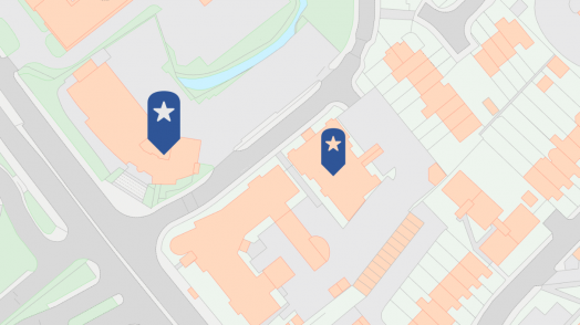
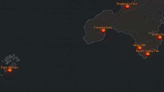
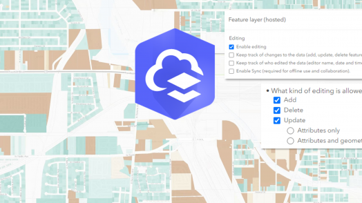
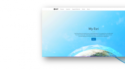
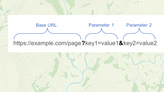
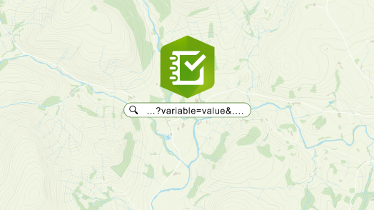
Blog Esri UK Tech Blog CategorySelect3DCartographyContentData ManagementDeveloperMobileProduct NewsSpatial AnalysisTipsTechnologySelectAppsArcadeArcGIS EnterpriseArcGIS Experience BuilderArcGIS Living AtlasArcGIS OnlineArcGIS ProArcGIS StoryMapsDevelopersMobileReport Builder for ArcGISSweet for ArcGISUK ProductsUtility Network EditorSearch Tips Creating Web Apps with Design in Mind 16th January 2024 Beautiful cartography, effective labels, elegant styles – a lot of time and effort goes into creating maps. But we shouldn’t stop at the maps we create. A well thought through app design isn’t just about making something ‘pretty’, it’s about... Read more Tips Utility Network web editing tools at your fingertips (literally) 7th December 2023 Why edit a utility network? You can switch on your lights, fill the kettle, and turn on the heating thanks to complex networks distributing electricity, water, and gas to our homes and businesses. Without a good understanding of a utility …... Read more Tips What is GIS? Five key concepts to improve your understanding 16th November 2023 When you’re running late for work and trying to find shortcuts along your route, you’re using GIS. When organisations have digitised plans of their estate, also GIS. Biologists tracking animal migrations… You can guess where I’m going with this. S... Read more Spatial Analysis Analyse and visualise imagery in ArcGIS Online 3rd November 2023 Picture this – 4,000 active satellites orbiting the earth, sensors whirring (I know that they’re not making a sound because space is a vacuum but I’m taking artistic license). Some of these capture high resolution imagery, which provide organisati... Read more Cartography Creating a spooky map with the Living Atlas 26th October 2023 Halloween is just around the corner, and what better way to celebrate than with a spooky map? Inspired by the Inferno map by John Nelson, we wanted to produce a scary map that centred on Halloween-related place names. In this … Read more Mobile Automating workflows in ArcGIS with our mobile apps 19th October 2023 Wouldn’t it be great if you could be alerted when a mobile worker adds, edits or deletes data whilst out in the field? Or how about if a report is automatically created for you to review after your data is … Read more Tips Getting to grips with ArcGIS Connectors for Power Automate 18th October 2023 ArcGIS Survey123 users have had the ability to enhance their workflows through automation for some time now, using connectors available in Power Automate and Make (formally Integromat). If you wanted to configure automated post-capture workflows f... Read more Tips Web-editing in ArcGIS: learn to easily manage feature layer edits 27th September 2023 Create polygons for building outlines. Update attributes for utility networks. Delete outdated bird spotting points from your wildlife watcher’s map (or feel free to insert your own oddly specific example to further progress this introduction). Wh... Read more Tips Getting to know My Esri: insights from Technical Support 21st September 2023 Being organised makes things easier, regardless of what it is we’re talking about (though I’m hoping you know where I’m going with this considering the title). With administrative tasks, having everything in one place limits the time you spend sea... Read more Tips Customising your ArcGIS experience with URL parameters 13th September 2023 Did you know that many of the web and mobile applications in ArcGIS Online and ArcGIS Enterprise support the use of URL parameters to call your apps with additional instructions that define how you want them to appear to end … Read more Tips Getting started with URL parameters in Survey123 13th September 2023 Like many aspects of ArcGIS Online, web forms built using Survey123 can be accessed and modified in unique ways using URL parameters. In this blog, I’ll dive into how we can use them to help make submitting surveys a more … Read more Product News Cover more ground with the new Maps+ beta services 5th September 2023 The new Maps+ Beta services are now live and available to existing Maps+ subscribers from within the ArcGIS Marketplace (sign in required). In anticipation of this, I took the opportunity to get to know the new arrivals to the Maps+ family. &hell... Read more Pages: 123456789101112131415161718192021222324Load More